

Ynys Môn (the Isle of Anglesey), once called the Mother of Wales, has bags of character. Perched in the far northwest of Cymru, it has always had a strong sense of otherness. Where else would the locals have been bold enough to cook up Britain’s longest place name, Llanfairpwllgwyngyllgogerychwyrndrobwllllantysiliogogogoch?
There’s an independent spirit at work here, but that’s not to say it’s unwelcoming. The island has a genuine flavour, so much so that everyone, from day-trippers checking out Biwmares' (Beaumaris) buzzing new restaurant scene to a certain Royal couple, is made to feel at home.
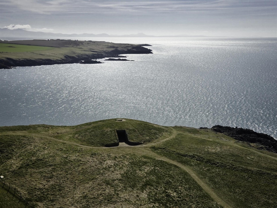
Less than 300 square miles in extent, the island is far smaller than most British counties, but there’s plenty of variety in its breezy, open landscapes. Much of Môn's 125-mile coast is a National Landscape – a lovely collection of sand dunes, coves and cliffs, with pretty villages and pebble beaches. It’s particularly beautiful in spring, when the clifftops are sprinkled with wildflowers.
Ancient burial chambers, grand Victorian bridges
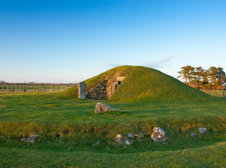
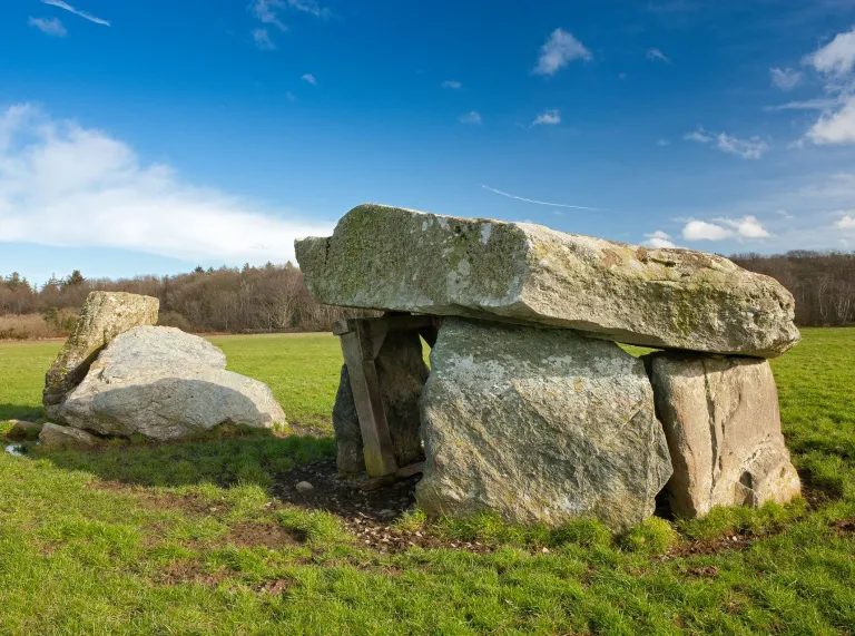
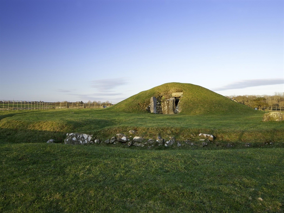
The defiant spirit you’ll find on Môn today has its roots in the distant past. The island was considered holy by the Celts; it was a stronghold of their priests, the Druids, who planted it with groves of sacred oaks. This was the last pocket of Wales to resist the Roman invasion in the first century AD. For the advancing army, the island’s rich copper reserves were well worth the fight. Before that, Môn had been home to Neolithic and Bronze Age communities, whose burial mounds remain.
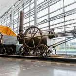
The 18th and 19th centuries brought huge changes. In the 1760s, an investigation of the old Roman copper mines on Parys Mountain led to the discovery of a huge lode, close to the surface. By the 1780s, Parys Mountain was the largest and most productive copper mine in Europe and its copper was used to make wooden ships copper-bottomed, boosting Britain’s dominance as a seafaring nation.
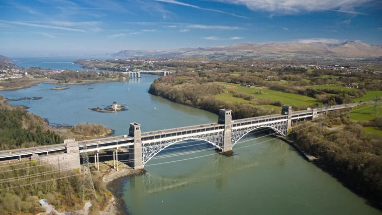
In 1826, Thomas Telford completed the world’s first major suspension bridge, the Menai Bridge, giving the island its first permanent Menai Strait crossing. Then in 1850, Robert Stephenson added a rail bridge, the Britannia Bridge, a final vital link in the direct rail and sea route from London to Dublin.
Following the coast
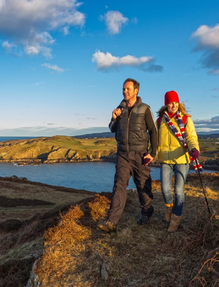
A stroll or a hike along the Anglesey Coast Path is a great way to explore. Some sections double as a cycle route and bridleway. If you have time, you could make your way round the entire 125-mile circuit, passing wild beaches, flower-dotted heathland and mud flats busy with birds. You’ll need a couple of weeks to do the route justice. Once you’ve made it all the way round, you can claim a badge and a certificate from the Friends of the Isle of Anglesey Coastal Path.
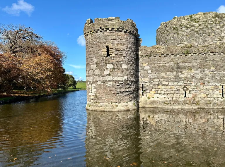
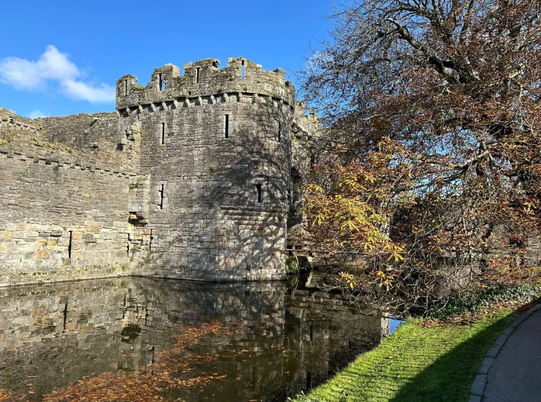
Alternatively, you could tackle the path in chunks. There are many beautiful stretches to choose from. The island contains three of the six Welsh Heritage Coasts: North Anglesey from Church Bay to Dulas Bay, Holyhead Mountain in the west and Aberffraw Bay in the southwest. It’s also home to some fine architecture: gracing the southeastern shores are Plas Newydd, an elegant National Trust mansion, and the World Heritage listed Castell Biwmares (Beaumaris Castle).
Read more: Bird watching on Anglesey with David Lindo

Things to see and do on the Isle of Anglesey
For a small island, Anglesey packs in a heck of a lot. Here are ten favourites to get you started.

Family friendly Anglesey
Alison Lea-Wilson gives a guided tour of Anglesey and some of the best family attractions.

Zip-boing: brilliant activities for a holiday you'll never forget
Discover thrill-seeking activities and adventures in North Wales for all the family.
Discover our seven National Museums
For Welsh history and culture, our seven, free entry National Museums take some beating.
Things to see and do on the Isle of Anglesey
For a small island, Anglesey packs in a heck of a lot. Here are ten favourites to get you started.
Family friendly Anglesey
Alison Lea-Wilson gives a guided tour of Anglesey and some of the best family attractions.
Zip-boing: brilliant activities for a holiday you'll never forget
Discover thrill-seeking activities and adventures in North Wales for all the family.
Discover our seven National Museums
For Welsh history and culture, our seven, free entry National Museums take some beating.
We'd Like to Hear From You
By answering a few questions, we'll give you the chance to win one of three £100 prizes. By doing so you will also help us improve this website and help with your holiday planning and travel needs.
Good for you. Good for us. Teamwork!