North Wales
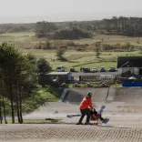
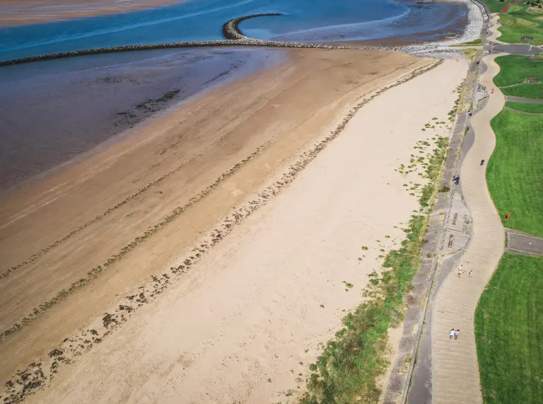
Prestatyn to Rhyl
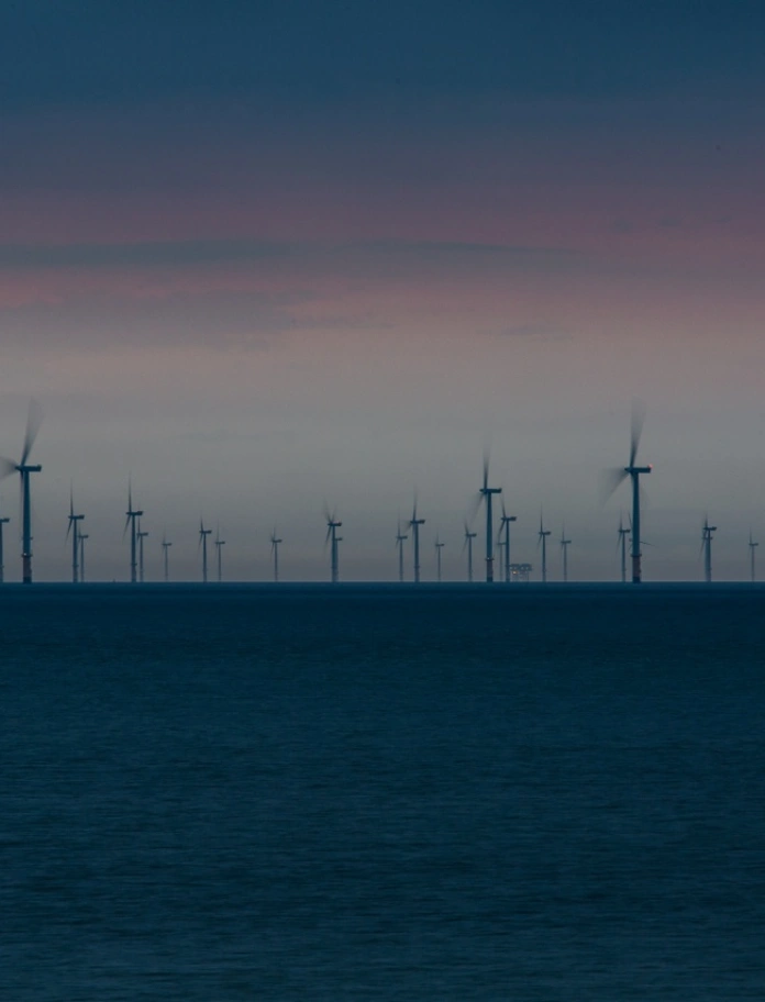
The Wales Coast Path and the National Cycle Route 5 share the same route along this stretch. It's around 6 miles (9km) from Prestatyn to Rhyl. The path is smooth tarmac or concrete all the way and mostly flat with just a few small slopes and ramps. The views out to sea are huge - wide expanses of sand with the vast windmills of the North Hoyle Offshore Wind Farm in the shimmering distance. There are toilets on the promenade at Prestatyn and Rhyl and cafés and ice cream kiosks en route. If you get your timings right, you can catch the train back.
Distance: Around 6 miles (9km) one way
Surface: Smooth tarmac and concrete.
Allow: 4 to 5 hours
Read more: Easy access walks on the Wales Coast Path
Abergele to Llanddulas
This section is almost completely flat and the surface is smooth tarmac all the way. It's shared with the cycle path so keep an eye out for cyclists and pedestrians. There are leafy hedgerows and hillsides to one side and breakwaters and the wide open beach and sea to the other. Tides Café just at the caravan park, makes a good stop off point about two thirds of the way. As you reach Llandulas, the tarmac path winds gently through grasslands and across a bridge over the Dulas river.
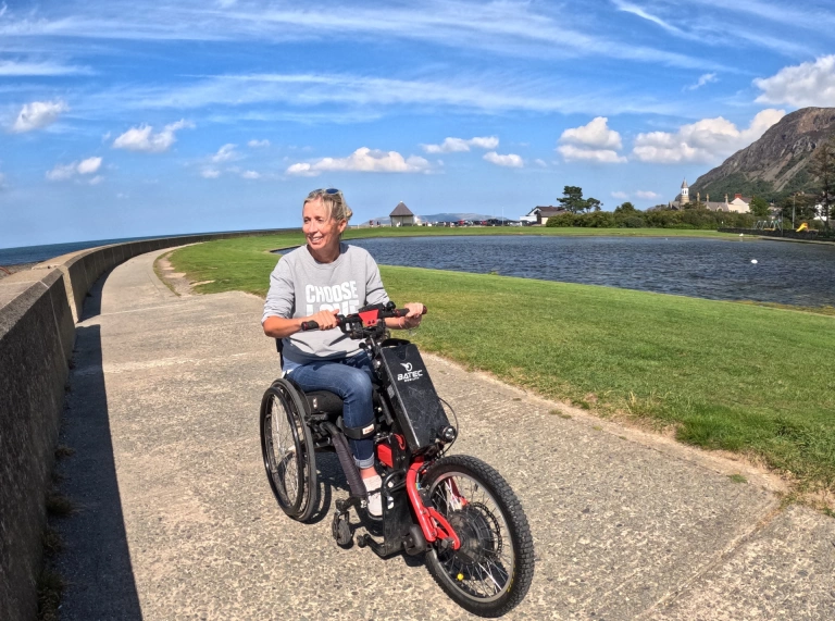
Using her wheelchair and trike, fundraiser Amanda Harris has been exploring the accessible sections of the Wales Coast Path, raising money for the Welsh Spinal Injuries Unit. Amanda's review of this walk: 'This is a lovely long path on the North Wales coast. I have chosen it as it's accessible to wheelchair users, with plenty of cafés, pubs and disabled loos.'
Distance: About 3 miles (5km) one way
Surface: Smooth tarmac
Allow: 2 to 3 hours
Read more: Accessible holidays in North Wales
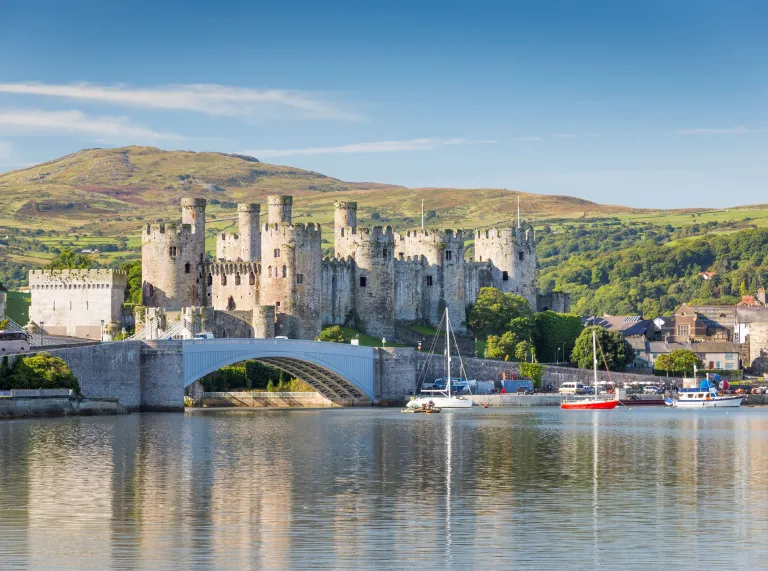
Conwy to Deganwy
There are pavements and a short stretch of road to navigate on The Two Marina walk. From Beacons car park at Conwy Marina, follow the footpath around its tranquil waters. Then use the smooth pavements on Ellis Way and Morfa Drive until you pick up the path through tranquil Bodlondeb Woods Nature Reserve.
At Conwy Quay you pass the smallest house in Britain and then reach mighty Castell Conwy (Conwy Castell). You need to use a quiet side street here as the pavement has steps. Cross the river bridge on the pavement and follow the smooth path by the river to Deganwy Marina with views right down the estuary. Toilets are available at Conwy Quay and Deganwy Marina, and there are several places for a bite to eat.
Distance: Around 3 miles (4km) one way
Surface: Pavement and tarmac, short sections on the road
Allow: 2 to 3 hours
Read more: Exploring Llandudno by wheelchair
Llanfairfechan to Morfa Madryn nature reserve
Starting from Llanfairfechan promenade, the circular Llanfairfechan to Morfa Madryn route passes alongside the beach, saltmarshes and through nature reserves. With plenty of bird life it's a great outing for nature lovers, and provides the opportunity to admire the views out to Ynys Seiriol (Puffin Island).
Amanda's highlights of this walk: 'I loved the wooden benches at Glan y Môr Elias nature reserve, carved with the names and pictures of the birds you can spot.'
Distance: 4 miles (6.5km) including the nature reserve loop
Surface: Smooth tarmac and compacted gravel
Allow: 1 to 2 hours
Read more of Amanda's experience of exploring the North Wales coast on the Wales Coast Path website.
Mid Wales
Aberporth to Tresaith
There are sparkling views over Cardigan Bay along this section and you might see dolphins among the waves. Start at Brynseiol Chapel car park off Heol y Graig, east of Aberporth Bay. The path takes you along the clifftop eastwards towards Tresaith, past rocky coves as far as a small waterfall. Then, retrace your route back.
The bird life is abundant. Look out for stonechats, meadow pipits and even rare choughs. There are picnic benches along the way. Accessible toilets are back down on Aberporth Beach at Glanmordy and Cwtch is a friendly café with views across the beach.
Distance: About 1 mile (1.6km) return journey
Surface: Smooth tarmac
Allow: 2.5 hours
Read more: Discover Mid Wales' accessible attractions
West Wales
St Govan's Head
Amanda explains why, although it's quite a short section, St Govan's Head is one of her favourites so far: 'The scenery is spectacular and it allowed me to really experience the full wild and rugged nature of the Welsh coastline. I was pleasantly surprised by the provision of disabled parking in this relatively remote area, but to the best of my knowledge there were no loos and certainly no cafés.'
A tarmac path leads from the car park half a mile or so to the coastguard lookout where there are awesome sea views. There's a cattle grid at one point but you can avoid it by going through a wide kissing gate.
Fancy a full on adventure? Head west out of the car park along the clifftop Wales Coast Path. The surface is loose stone, navigable for trikes and mobility scooters. Keep on the path passing smugglers' coves and craggy rock formations, all the way to the two massive pillars of limestone at Stack Rocks, often thronging with seabirds. There are some gradients and gates to deal with on this section.
This area is part of a live firing range and regularly closed to the public. Check before you set off by calling 01646 662367 or see the UK Government Castlemartin firing information page.
Distance: 1.1 miles (1.8 km) coastguard lookout return journey
7 miles (11km) Stack Rocks return journey
Surface: Tarmac/loose stones
Allow: 90 minutes for the viewpoint
5 to 6 hours for Stack Rocks
Read more: Access for all on the Pembrokeshire coast
Swansea Bay to Mumbles Pier
The coast path around Swansea Bay is smooth and flat - easy wheeling for over 7 miles (11km). Start in Swansea harbour where there are lots of parking and eating options. The long promenade stretches right around the bay.
Clumps of sand dunes and the wide open sandy beach disappear off into the distance. There's a leafy park on the inland side with cafés and kiosks for a cuppa or an ice cream. Further on, cross Blackpill Bridge over the Clyne to reach the prom at Mumbles. You can continue all the way to the pier. There's an accessible toilet at Mumbles lifeboat station (radar key required).
For a much shorter trip start in Mumbles at Swansea View or Knabb Rock car parks and head to the pier and back.
Amanda's review of this section: 'Seeing the Mumbles lighthouse in the distance at the far end from Swansea Marina is a bit daunting, but there's always a feeling of a great achievement when you get there and enjoy a fully deserved ice cream!'
Distance: 7 miles (11km) one way
Surface: Smooth tarmac and concrete
Allow: 4 to 5 hours
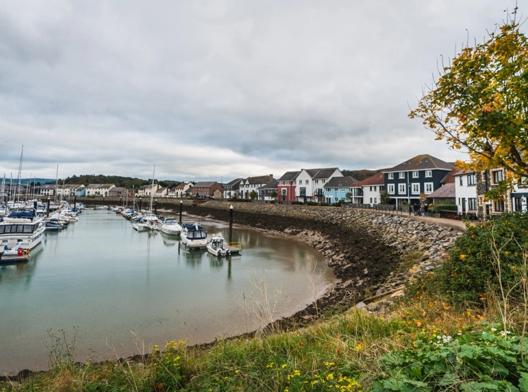
Millennium Coastal Path
Start at Millennium Quay car park at North Dock, Llanelli. St. Elli's Bay bistro has toilets and a café. The smooth flat promenade offers great views across the beach and sculptures along the route. Continue over the landscaped railway bridge to the fantastic viewpoint at the Needle Sculpture. Sandy Water Park here has a lake with ducks and swans. On to Pwll, with more landscape sculptures to admire. Passing the Pavilion Café you reach Burry Port with its harbour, marina and lighthouse. If you keep going you pass the old Pembrey Harbour with sand dunes and the estuary packed with wildlife, arriving at Pembrey Country Park. The visitor centre has accessible toilets and a café.
Distance: 4 miles (6.5km) one way
Surface: Smooth tarmac and concrete
Allow: 2 to 3 hours one way
Read more: Accessible attractions in West Wales
Aberavon Beach
The long stretch of golden sand at Aberavon Beach is delightful in almost any weather. It's around 3 miles (5km) from one end to the other. The promenade has a smooth tarmac pathway and it's completely flat. There are car parks in several locations and accessible toilets too. You'll likely see surfers and kite surfers cresting the waves, whilst the sands are a magnet for sandcastle builders. On the shoreside you'll see sculptures, gardens, a kids' playground, skate park and aqua park in summer. There are cafés and kiosks for a bite to eat or an ice cream in the sunshine.
Distance: About 3 miles (5km) one way
Surface: Smooth tarmac
Allow: 2.5 hours
Read more: Great Welsh beaches with easy access
South Wales
Porthcawl to Kenfig Dunes
The promenade at Porthcawl is an old favourite of Amanda's, with plenty of benches, on road parking and facilities along the front. And it is now possible to follow the path all the way around to Rest Bay (accessible parking and loos available). Extend past the golf course on the step-free boardwalk out towards the dunes at Kenfig National Nature Reserve.
Distance: Rest Bay to Kenfig is 3 miles (5km)
Surface: Concrete paths, boadwalk over the beach (expect debris on pathway after bad weather), grassy/sandy paths if you go further towards the dunes
Allow: 2 hours
Newport Wetlands Centre Nature Walk
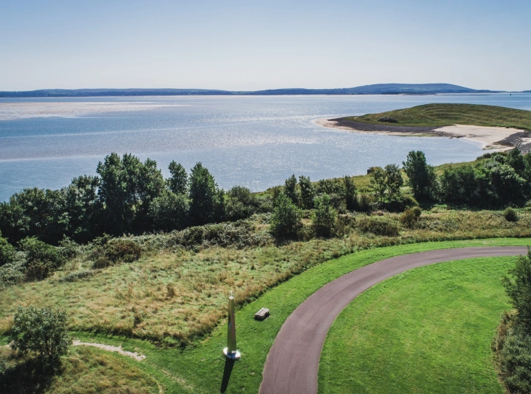
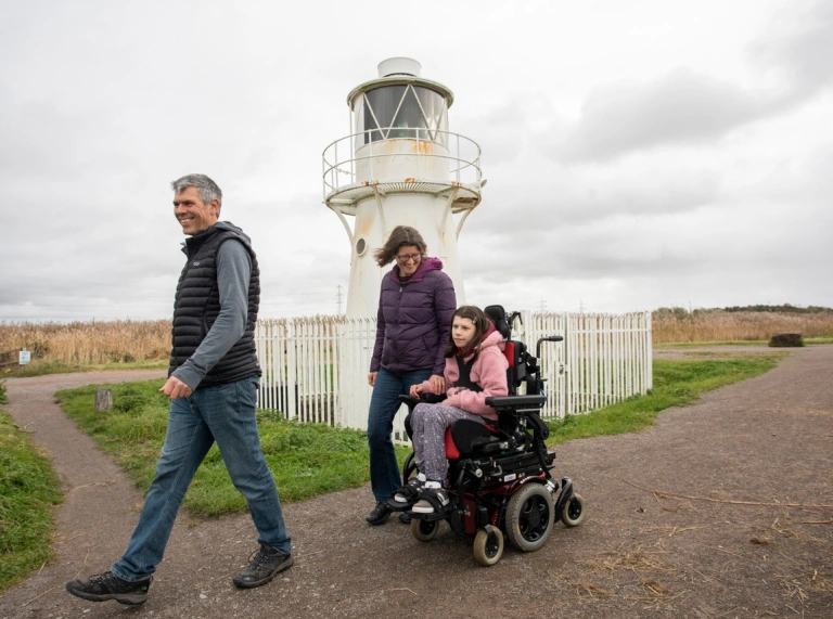
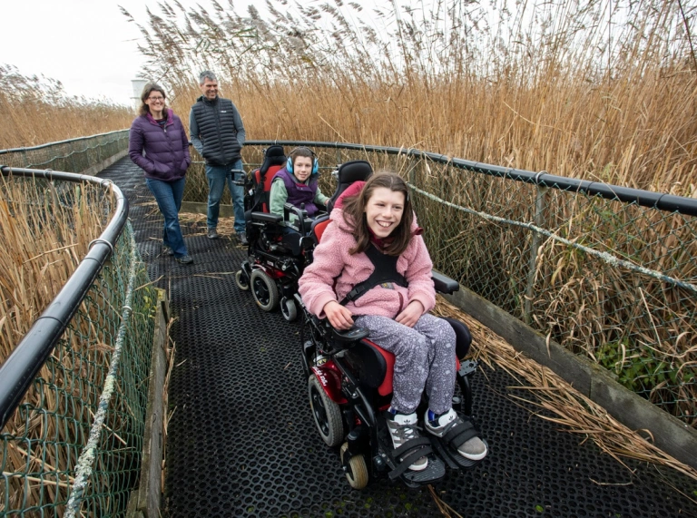
If you like the idea of combining birdwatching with your trip, the RSPB Newport Wetlands Centre offers the best of both worlds. A 3 mile (5km) accessible trail leads from the visitor centre taking in woodlands and grasslands where you may see orchids in late spring, down to a section of the Wales Coast Path. You pass the 120-year-old East Usk lighthouse, with views across the mudflats and opportunities to see wading birds like egrets and dunlins. There's also a sculpture trail through the reedbeds and over a floating bridge. The visitor centre has accessible toilets and a café. You can hire binoculars too.
Distance: 3 miles (4.5km) return journey
Surface: Hard stone
Allow: 2 to 4 hours
Planning a Wales Coast Path trip
- To help plan your trip, we recommend you read our handy Wales Coast Path guide.
- Adventure Smart Wales has plenty of safety advice about how to ‘make a good day better’, and we recommend you read it before planning your days out.
- Please be respectful of our beautiful land and other people, and follow the Countryside Code.
- If you bring your dog along, follow the Dog Walking Code.
- Discover more Wales Coast Path Accessible walks.
Useful apps to download:
- Wales Coast Path app - there's plenty of information on there that you won’t find on maps.
- Wales Coast Explorer app - it helps you identify wildlife, flora, explore heritage sites along the way, and record your findings.