
It’d been a long drive. We slid the side door open and relaxed on the sofa bench, enjoying the warm breeze as it filled the campervan with the briny smell of the sea. My partner Heleyne and I were looking forward to exploring the Wales Coast Path from our pitch at Ty Newydd Farm campsite on the Llŷn Peninsula, the slender ribbon of land jutting out into the Irish Sea at the north-western tip of Wales. Aware of how busy sites could get, we’d booked well in advance and weren’t disappointed.
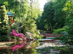
Llŷn's coastal landscape
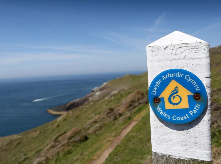
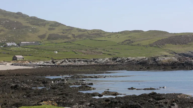
On our first day, we walked from the farm and completed a 10-mile (16km) circuit of the rugged cliffs at the tip of Llŷn – along the north coast, across the neck of the headland to Aberdaron, where the poet R S Thomas used to preach, and then back along the south coast. It was a walk of open heathland, secretive coves, fort-topped headlands and wave-sculpted cliffs, following the reassuringly well-signposted Wales Coast Path for most of the journey.
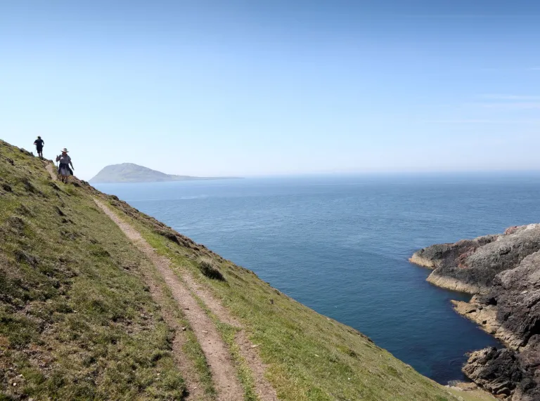
From Mynydd Mawr (Welsh for ‘great mountain’), we could see Ireland’s Wicklow hills on the hazy horizon while just a couple of miles offshore was Ynys Enlli (Bardsey Island). A place where legend and history collide, Enlli is said to be the site of a Celtic monastery – one of the earliest in Wales – as well as the burial place for 20,000 Welsh saints. Boat trips run most days during the summer.
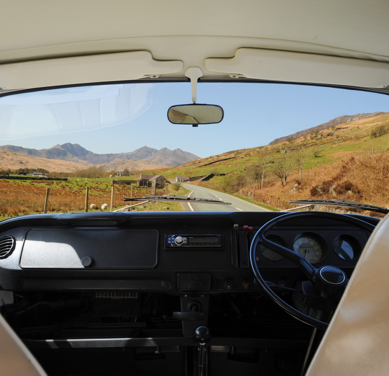
It's not easy getting to Llŷn but that, for me, was one of its attractions. After leaving the North Wales Expressway at Bangor and then getting round the A487 Caernarfon bypass, increasingly narrow lanes lead slowly into a pastoral landscape where time seems to be standing still. Moving down a gear, literally and metaphorically, was no bad thing; it felt like we’d gone back to another, less frantic era.
Campervanning made easy
We stocked up on groceries at Pwllheli on the south coast, but there was no shortage of small shops in other towns and villages such as Nefyn, Llanbedrog, Abersoch and Aberdaron. We found great pubs for lunchtime stops on our walks too, including the beautifully situated Tŷ Coch Inn at Porthdinllaen, where you step from the terrace straight on to the beach.
If it’s fish and chips you’re after – and who isn’t when they’re at the seaside? – I can recommend Sblash in Aberdaron.
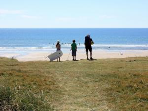
Parking campervans and motorhomes can sometimes be a problem in coastal areas, with many car parks having height barriers, but we didn’t have any difficulties on Llŷn. Even busy Porth Neigwl, popular with surfers, has space outside the main car park for larger units. From here, we visited Mynydd Cilan, Llŷn’s southernmost headland. We were lucky, on our walk, to spot two adult choughs using their curved red bills to prise insects from the ground and fill the squawking mouths of their two demanding youngsters. It’s not surprising this unusual-looking member of the crow family is the symbol of the Llŷn Area of Outstanding Natural Beauty – even though it’s rare, we saw several on our trip.


On to Eryri (Snowdonia)…
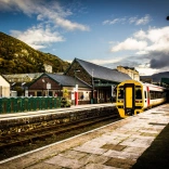
On a separate trip, we used our campervan to walk the Wales Coast Path along the edge of the Eryri (Snowdonia) National Park. The 49-mile (79km) section from Porthmadog to Aberdyfi is shadowed by the Cambrian Coast Railway. Regular services calling at 20 stations made it easy for us to base ourselves at a couple of campsites, leaving the 'van hooked up for a few days while we hopped on and off the train to walk linear stretches of the trail. We stayed on a site at Harlech for the northern half and at Hendre Mynach Caravan Park near Barmouth for the southern half. Both had excellent facilities, including toilet and shower blocks, laundry areas, chemical disposal points and playgrounds.
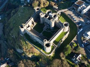
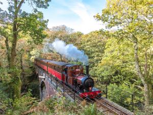
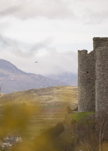
Alternating days of 12 to 14 miles (19-23km) with shorter walks of between 6 and 9 miles (10-15km) allowed time for dawdling and visiting attractions such as the fanciful Italianate village of Portmeirion, the substantial, crag-top ruins of Castell Harlech (Harlech Castle) and the Talyllyn Railway, the world’s first preserved heritage line. This seven-mile, narrow-gauge railway was built in the mid-1860s to serve a local slate quarry. After the business closed in 1947, it seemed the line would be lost forever, but a group of enthusiasts stepped in, restored it and have kept it running ever since. With the noise of the steam engine puffing its way up into the hills, it was a fun way to take a break from the trail.

The biggest beaches
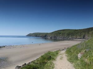
Back on the coast path, we hiked beside wooded estuaries, across salt-marshes rich in birdlife and along some of the longest beaches I’ve ever seen, including beautiful Morfa Dyffryn. The beaches on Eryri's coast are backed by immense dune systems and, as we walked along the sand, I had a wonderful feeling of isolation, of being cut off from the rest of the world. There was nothing but sand, sea and jaw-dropping views – to the north, Llŷn reached out into the vast, blue emptiness; further east, Wales’ highest mountains were visible, with Yr Wyddfa (Snowdon) prominent.
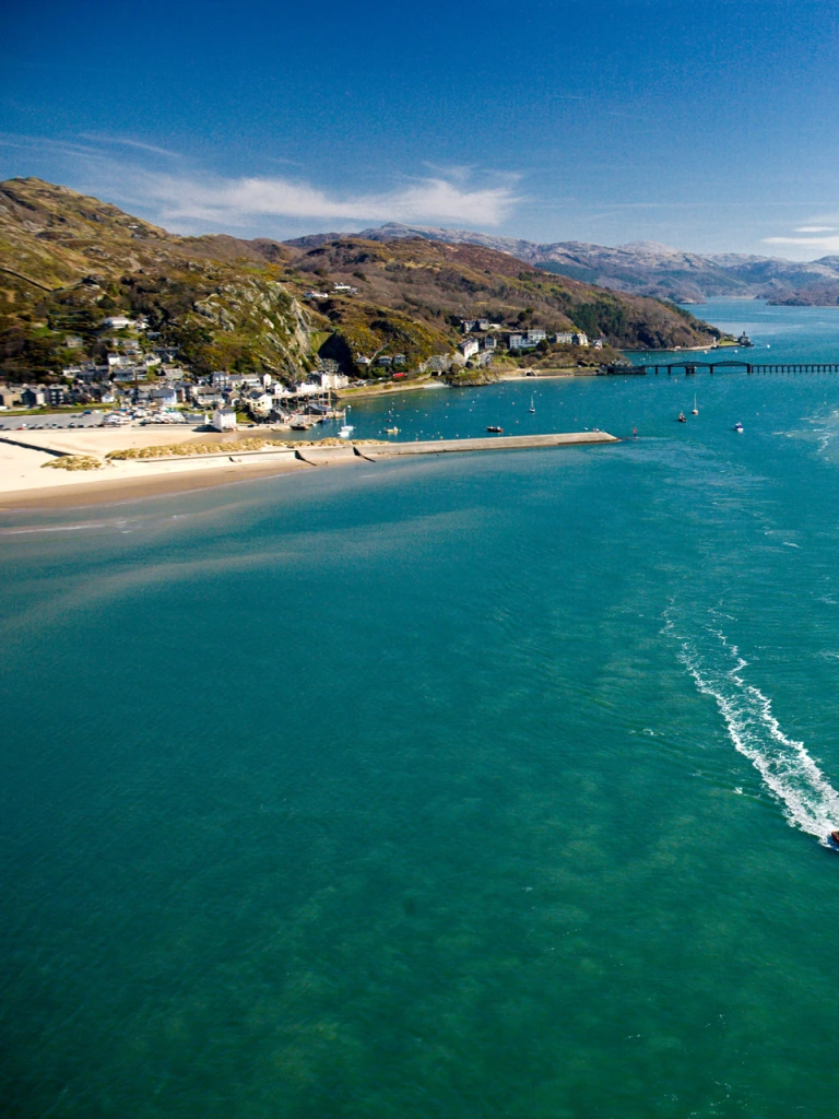
Nature, however striking, took a back-seat at Barmouth when we crossed the broad Mawddach estuary on the magnificent Barmouth Bridge. Built in 1867 for both rail and foot traffic, this half-mile-long structure consists of a largely timber viaduct and a metal swing-bridge section that used to be opened to allow large ships to sail upstream. It should take about 10 minutes to cross, but I couldn’t help dawdling, taking in the fabulous scenery. In one direction, the unhurried river emptied into Cardigan Bay (Bae Ceredigion); looking inland, the hills rose steadily towards Cader Idris, the highest point in the area. The perfect combination of sea and mountains – so typical of the coast path in North Wales.