Legend has it that Cader is named after a giant called Idris Gawr. ‘Cadair Idris’ in English means ‘Chair of Idris’, while 'Cader' could also refer to an ancient fortress. It's locally known as Cader Idris rather than Cadair, but either may be used. The most well-known local fable is that if you spend the night on the mountain, you’ll end up mad or a poet. Staying overnight on the peak is definitely not a good idea, as the small shelter is exposed and could be dangerous in bad weather. There are many cliff edges to be aware of, especially in low visibility.
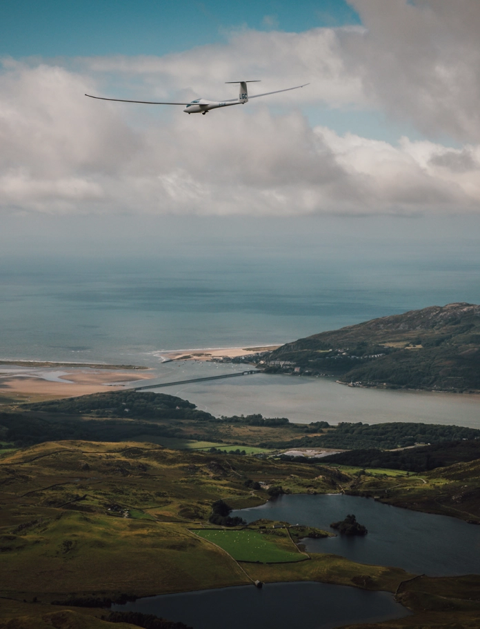
The eastern slopes are a regular haunt for fans of the Mach Loop low flying aircraft practice area, and on good days gliders from further up the coast swoop by high above the valleys below.
Where is Cader Idris located?
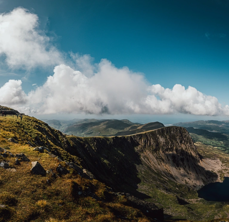
For the people of southern Eryri, Cader Idris is a constant presence in their lives. The distinctive shape of the mountain's peaks can be seen for miles around, from the coastlines at Tywyn and Abermaw (Barmouth) and high over the market town of Dolgellau. The summit of Penygadair is a sharp contrast to the gentler hills below - when the clouds lift from the peak, that is!
The nearest main line railway stations are Machynlleth, Tywyn and Abermaw. Minffordd has a nearby bus stop, however you’ll need to walk a few miles from Dolgellau or Abergynolwyn to get to the other starting points. The T2 Trawscymru service stops at Minffordd (bus stop name: Minffordd, Gwesty i Gader Idris/Hotel for Cader Idris) and Dolgellau. Traveline Cymru is a useful journey planner for public transport in the region.
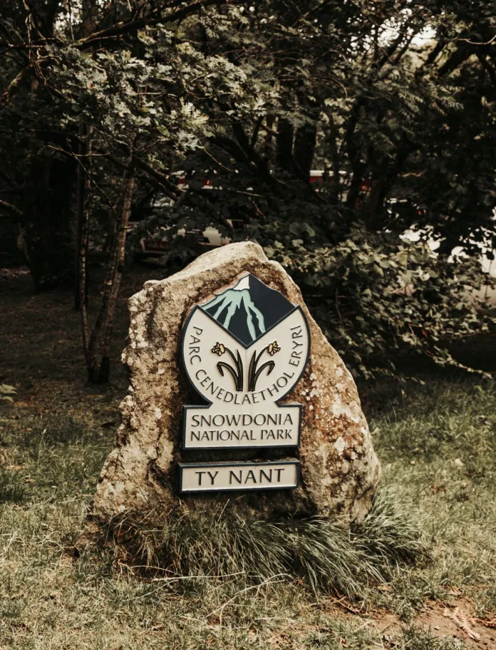
You can park your car at Dôl Idris (Minffordd), Llanfihangel y Pennant and Tŷ Nant. The Dôl Idris and Tŷ Nant car parks are run by Eryri National Park and there is a charge to use them - they accept card payments only. Find out the up to date information on the Eryri National Park car parks page. It’s best to get there early as they can fill up at busy times. The Llanfihangel y Pennant village car park is free to use but it’s very small.
There are toilets at each of the car parks which you should use before you start walking, as there aren’t any on the mountain.
Cader Idris routes
The Pony Path (Tŷ Nant)
10km / 6 miles, allow 5 hours there and back
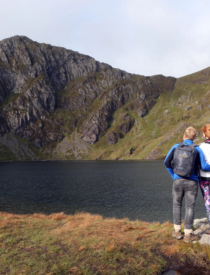
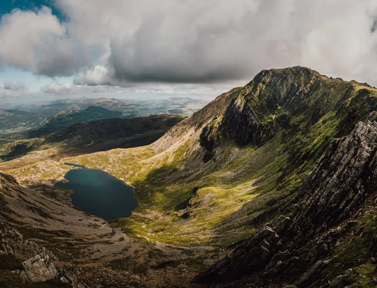
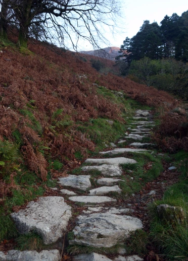
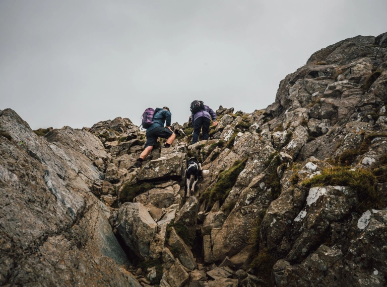
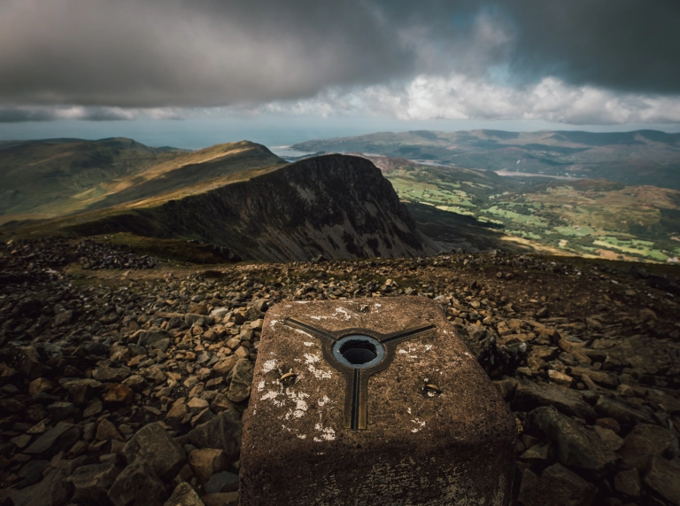
The Pony Path starts from the Dolgellau side of Cader. It’s probably the most popular route, heading up the mountainside to the curve of the cliff edge above Llyn y Gader. Starting from Tŷ Nant car park, it's a steepish climb with steps in several places to help you along. On the way you’ll see spectacular views over the Mawddach estuary towards Abermaw. Once you get to the ridge over Llyn y Gader you'll get fab views inland towards Y Bala and over the lake. Follow the steep path to Penygadair. Then it's a scramble up to the trig point.
Minffordd Path
10km / 6 miles, allow 5 hours there and back
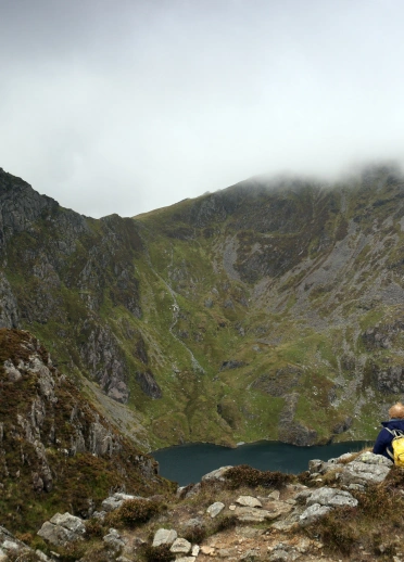
The shortest route but the steepest. The Minffordd Path starts near the Visitor Centre. To start with, you’ll climb up lots and lots of steps, before walking along the ridge above Llyn Cau toward Penygadair. Take care coming back down from the summit, as it’s easy to miss the path and you probably don’t want to end up walking towards Dolgellau.
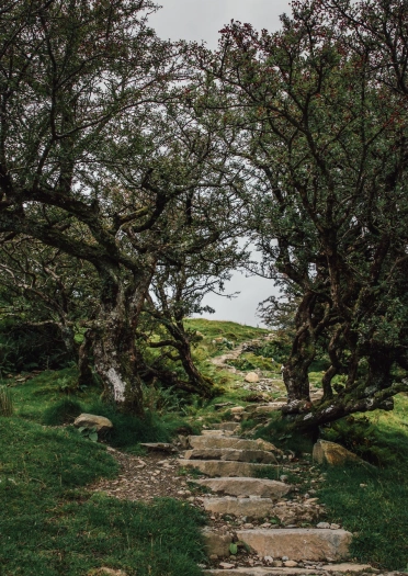
The seasonal Visitor Centre is worth a visit as there’s plenty of information about Cader. There are also short walks around the nature reserve, including accessible broadwalks, to explore the lower lakes and waterfalls. Coed Cadair is one of Wales' Celtic Rainforests, full of native trees and a wonderful, calming place to wander, surrounded by nature.
Llanfihangel y Pennant Path
16km / 10miles, allow 7 hours there and back
If you’re after peace and quiet, the longer Llanfihangel-y-Pennant Path is usually the perfect route to take. Llanfihangel y Pennant is a hamlet deep in the remote Dysynni Valley and an interesting place to visit in its own right. It’s reached by a narrow single track road, passing the romantic ruins of Castell y Bere on the way. The small car park and toilets are opposite St. Michael’s Church.
The path is fairly well marked. There are several places you can rest and appreciate the unfolding views of the Dysynni Valley down towards the coast or across to the summit. I do recommend you wear waterproof boots. The hillside paths can be very soggy, even in summer, and there is a wide-ish stream to ford along the way. Compared to the other paths, it’s fairly gentle until you join the Pony Path, then it’s a hard plod up to Penygadair.
Spend a little time exploring Llanfihangel y Pennant itself. As you walk out of the hamlet you’ll pass the remains of Mary Jones’ cottage. Mary was just 15 when in 1800, she walked 26 miles barefoot over the mountains to Y Bala to buy a Welsh language Bible she'd been saving up for years to pay for. Her story is told in the nearby St Michael's Church, where there’s also an incredibly detailed, beautiful handmade 3D patchwork map of the valley.
You can find out more about Mary's story at Canolfan Pererin Mary Jones Pilgrim Centre in Y Bala, and follow an approximation of her route along the Mary Jones Walk.
Key information about visiting Cader Idris
key-infoBefore travelling, check the Eryri National Park website or their Instagram @parc_eryri for the latest information on visiting, parking and conditions.
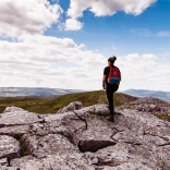
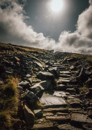
There are three recommended routes to conquer Cader. It’s not an easy walk by any means, whichever route you take. They are all designated ‘hard/strenuous’ routes, and you should allow between five to six hours to get there and back. You’ll need to take plenty of food and drink as there isn’t a café (or toilet) on the summit.
Weekends and bank holidays usually get very busy on the mountain. If you'd prefer a quieter walk, head up on weekdays in spring or autumn. During cold weather the paths can be covered with snow and ice, so please don't attempt it unless you are experienced and properly equipped.
Cader is a very popular day out for school parties, sponsored walks, or group challenges, especially as it is one of the Welsh Three Peaks.
Safety advice
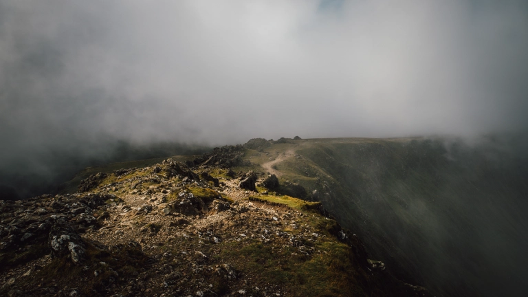
Fans of Susan Cooper’s The Dark is Rising series of books will recognise Cader as the home of the disturbing, but thankfully mythical, Brenin Llwyd - the Grey King - who appears as menacing, thick dark clouds on the slopes above Llyn Mwngil (Talyllyn Lake). It’s hard not to imagine a malign presence when the clouds do come down when you’re half way up the mountain…
...so be prepared for drastic changes in the weather and make sure you check the forecast before you go via the Met Office Cadair Idris forecast.
- Plan your route carefully and let people know where you are going, and what time you expect to be back.
- There’s a full list of recommended kit on the Eryri National Park website.
- Adventure Smart UK has plenty of advice on how to ‘make a good day better’, and we recommend you read it before planning your day out.
- Please be respectful of our beautiful land and other people, and follow the Countryside Code.
- Well-behaved dogs are welcome, but please keep them on leads as there is livestock on the mountain - follow the Dog Walking Code.
- Please take your litter home, and help to protect our fragile eco-system and wildlife by keeping to the designated paths for your own safety.
- Help Wales become the first Refill Nation by using nearby Refill Points to fill up your water bottle before you head off. Find out more including how to download the free Refill app to find your nearest Refill Point on the Refill Return website.
Frequently asked questions about walking up Cader Idris