
Eryri
Rocky, rough and tough – that's how we like our mountains. Don’t think that just because you can take a train to the top, Yr Wyddfa (Snowdon) isn't a proper peak. In fact, Eryri (Snowdonia) National Park is a mountain and adventure capital that's up there with the classic Alpine destinations.
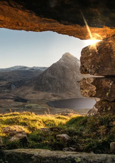
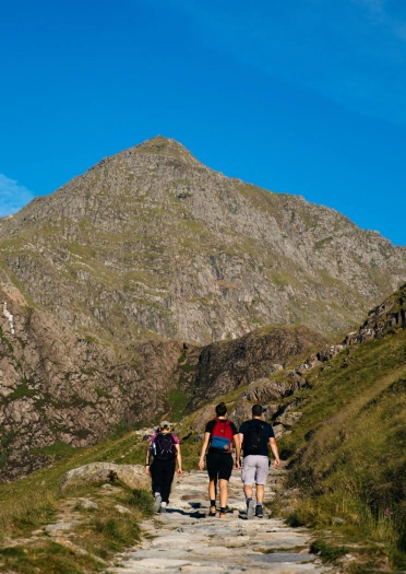
Each of the six official eight-mile routes to the highest mountain in Wales (1085m) offer sensational hiking and incredible views. In Eryri's nine ranges, there are 15 peaks over 900m high, including Yr Wyddfa itself. You may have heard of some of the others. Tryfan (918m) is a famous landmark: a triangular peak offering some of the best scrambling – and views – in Britain. Meanwhile, Cader Idris is 893m high and rears up from the shores of the beautiful Mawddach Estuary.
Cambrian Mountains
The Cambrian Mountains is a name that describes the sparsely-populated landscape from Foel Fadian (563m) near Penfforddlas and Pumlumon Fawr (752m) near Ponterwyd in the north, all the way south through the Elenydd and the Elan Valley to Mynydd Mallaen (462m) near Llanymddyfri (Llandovery). At its southernmost tip you’ll discover Mynydd Llanfihangel-rhos-y-corn (356m) near Brechfa Forest. The Cambrian Mountains span the three counties of Powys, Ceredigion and Carmarthenshire.
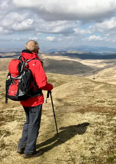
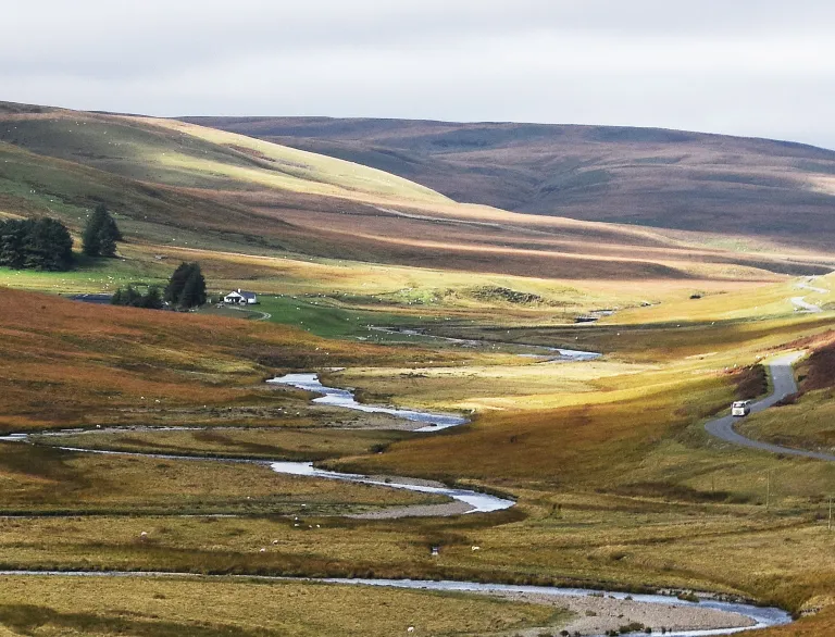
Located between Eryri and the Bannau Brycheiniog (the Brecon Beacons), the Cambrian Mountains include cairned summits, open moorland and lush valleys. They are home to the sources of the rivers Wye and the Severn and the peaceful Elan Valley reservoirs.
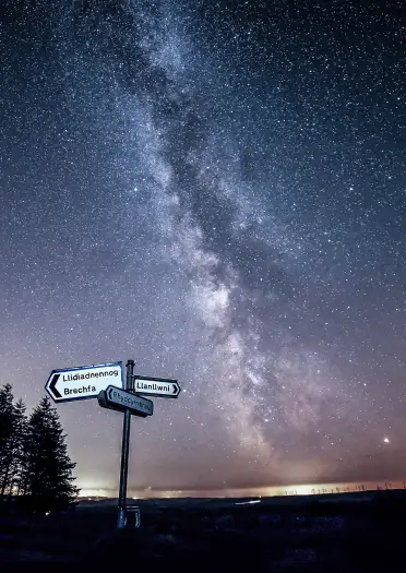
By day walk some local and National Trails, journey on your mountain bike or horse and even paraglide from quiet nearby peaks. By night you will discover some of the darkest skies in Europe by visiting the many Dark Sky Discovery Sites on the Cambrian Mountains Astro Trail.
Black Mountain Range, the Black Mountains, Fforest Fawr, and the Bannau Brycheiniog
The Black Mountain Range and the Black Mountains aren’t one and the same, although they are both found within the grassy expanses of the Bannau Brycheiniog National Park. The Black Mountain Range, sometimes just called Black Mountain, is to the west, north of Swansea. It’s one of Wales’ most wild and remote corners with impressive, glacier-carved escarpments and isolated lakes, several miles from the nearest road. Its highest peak is Fan Brycheiniog (802m).
The Black Mountains are to the east, on the border with England. Y Fenni (Abergavenny), Y Gelli Gandryll (Hay-on-Wye), Llangorse, and the Monmouthshire & Brecon Canal stand at their feet, and their highest point is the Waun Fach plateau (811m). Confusingly enough, this range is also home to a peak called Black Mountain.
To the southwest is Fforest Fawr (Great Forest), an upland area of remarkable limestone cliffs and caves. It was the the first Geopark in Wales.
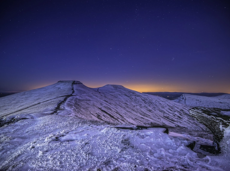
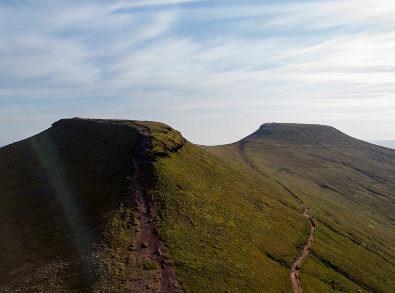
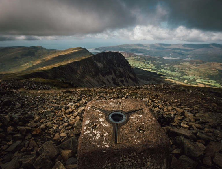
Dominating the centre of the Bannau Brycheiniog National Park are the Bannau Brycheiniog, whose most celebrated peaks, Pen y Fan (886m) and Cribyn (795m), are the highest in southern Britain. The Bannau Brycheiniog are popular, with plenty of footpaths and bridleways. But they’re quieter than Eryri. Head off on foot and at times it can feel as if you have an entire mountainside to yourself.
Be safe!
Exploring the outdoors is fantastic fun, but please read up on the risks and make sure you are prepared.
- Find safety advice for exploring Wales' National Parks and safety tips for staying safe on the Welsh coast
- Visit AdventureSmart.uk for information on how to stay safe whilst exploring Wales.
- Please follow the Countryside Code and the Dog Walking code.
Useful information
- Download the Y Marilyns app – find a recommended starting point a short route description and background information for Welsh hills and mountains which are 150m or more higher than the surrounding land (this is classed as a ‘Marilyn’). The app is free to download and is run by volunteers from the Relative Hills Society.
- Traveline Cymru is a useful public transport journey planner.
- There are a number of apps and online maps where you can to find the location of electric vehicle charging points across Wales. Several National Trust properties across Wales have EV charging points.
- Help Wales become the first Refill Nation by using nearby Refill Points to fill up your water bottle before you head off. Find out more, including how to download the free Refill app to find your nearest Refill Point on the Refill Return website.


