

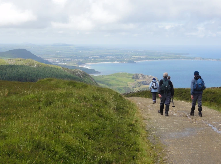
Pembrokeshire Coast Path National Trail
The Pembrokeshire Coast Path twists and turns its way through 186 miles (300km) of the most breathtaking coastal scenery in Britain. From Llandudoch (St Dogmaels) in the north to Amroth in the south, the trail covers almost every kind of maritime landscape from rugged cliff tops and sheltered coves to wide-open beaches, winding estuaries, ancient harbours and fishing villages. It takes about two weeks to do the whole thing – but it’s easy to break into short hops, using the excellent local bus service. While you're there, download the Wales Coast Explorer app - it helps you identify wildlife, flora, explore heritage sites along the way, and record your findings.

Highlights of the Pembrokeshire Coast Path
The northern section has a couple of fascinating features: the giant collapsed sea cave called Pwll y Wrach (the Witches’ Cauldron), and the Blue Lagoon, an old slate quarry that’s been picturesquely swamped by the sea.
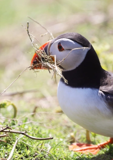
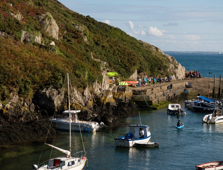
Head inland from the Roman harbour at Porthclais and you’ll soon reach the little cathedral city of Tyddewi (St Davids). On the opposite tip of St Bride’s Bay, the islands of Sgomer (Skomer) and Skokholm are a wildlife paradise.
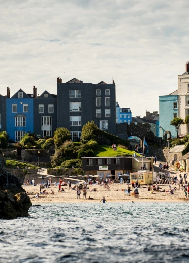
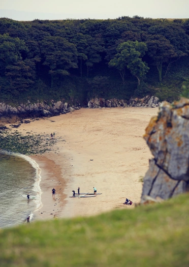
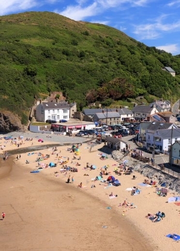
The Ystagbwll (Stackpole) Estate includes lovely lily ponds and the impossibly pretty Barafundle Bay, while Dinbych-y-pysgod is Wales’ most perfectly formed resort town.
Search for walking inspiration along the Pembrokeshire Coast Path.
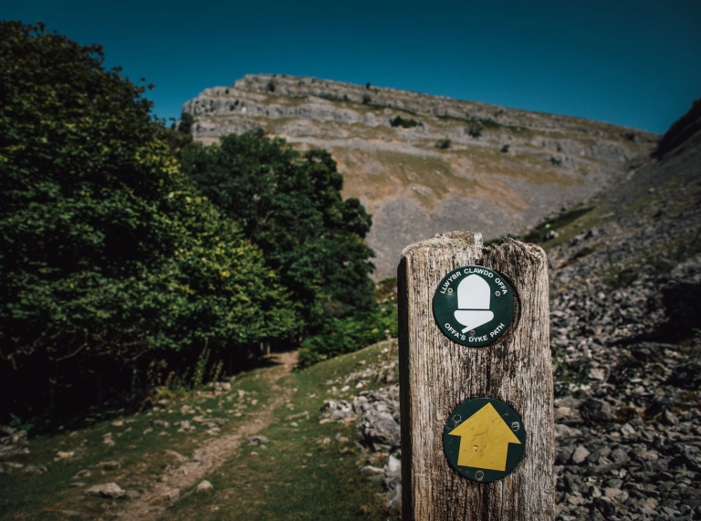
Offa’s Dyke Path National Trail
The 8th century King of Mercia built this mighty earthwork to keep the Welsh out (we’re a bit unruly, apparently) and it still roughly marks the present England-Wales border. The Offa's Dyke Path National Trail runs coast-to-coast for 177 miles (285km) through the beautiful borderlands, a changing landscape of mountain ranges and secluded valleys, dotted with some very fine market towns. The Offa’s Dyke Centre is at the mid-way point in Trefyclo (Knighton); it’s run by the Offa's Dyke Association, who are a great source of info and inspiration.

Highlights of Offa’s Dyke Path
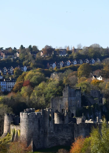
From the south, the trail starts on the English side of the River Wye, but it’s worth nipping across the river to visit Cas-gwent (Chepstow) Castle and the picturesque ruins of Tyndyrn (Tintern) Abbey.
The trail rises to its highest point along Hatterall Ridge, which runs along the Black Mountains range in the Bannau Brycheiniog (Brecon Beacons), with Llanddewi Nant Hodni (Llanthony) Priory below, and the classy book town of Y Gelli Gandryll (Hay-on-Wye) ahead.
Two splendid stately homes, Powis Castle and Y Waun (Chirk) Castle, are worth a diversion on the way to pretty Llangollen.
Moel Famau is the highest peak in the Clwydian Range, where you’ll follow a chain of summits and Iron Age hill forts before dropping down into the finish at Prestatyn.
Read more about Exploring Offa's Dyke Path.

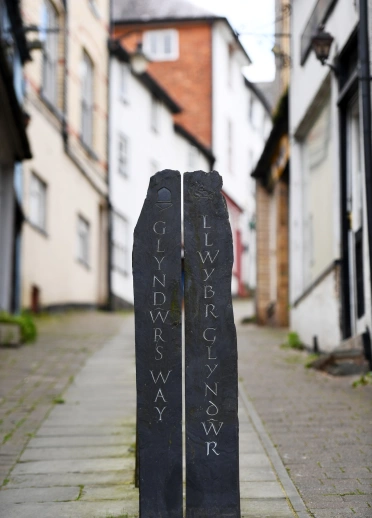
Glyndŵr’s Way National Trail
Owain Glyndŵr was the last native Welshman to hold the title Prince of Wales, leading a major rebellion against the English in the early 1400s. The 135-mile (217km) Glyndŵr's Way trail follows in his footsteps on a loop from Trefyclo to Y Trallwng (Welshpool), through rolling farmland and open moorland, past lakes and forests, through one of the least inhabited parts of Britain. The half-way point is Machynlleth, where Glyndŵr held his first parliament in 1404.

Highlights of Glyndŵr’s Way
The moorland northwest of Trefyclo is a taste of things to come: apart from the wildlife, livestock and the occasional farmer, you’re likely to have the place to yourself. Look out for the remains of Cwmhir Abbey: it was once the biggest in Wales.
The stretch from Llanidloes runs up past Llyn Clywedog up to the highest point on the trail, Foel Fadian, which has splendid views down to Machynlleth and the sea beyond. It’s worth taking a day off in Machynlleth – it’s got lots of good pubs and places to eat, which include the MOMA art gallery.
The trail leads through the Dyfnant Forest to the shores of Lake Vyrnwy, before following the River Vyrnwy down towards Y Trallwng, where you can finish off with a trip to Powis Castle.
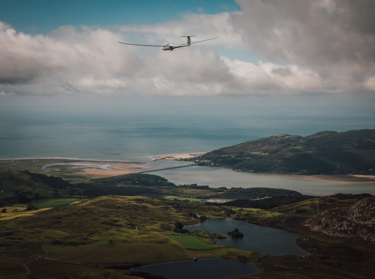
Wales Coast Path
In 2012 we created the world’s first uninterrupted route along a national coastline. The Wales Coast Path covers all the famous bits on its 870-mile (1,400km) odyssey: Penrhyn Gŵyr (Gower Peninsula), Pembrokeshire, the Cambrian Coast, and Pen Llŷn (Llŷn Peninsula). There are numberless beaches, estuaries, cliff-tops and woodlands. City waterfronts, castles and the occasional industrial site among the nature reserves but that’s part of Wales; part of the voyage of discovery. The Wales Coast Path app is really useful, as it has plenty of information that you won’t find on maps.

Highlights of the Wales Coast Path
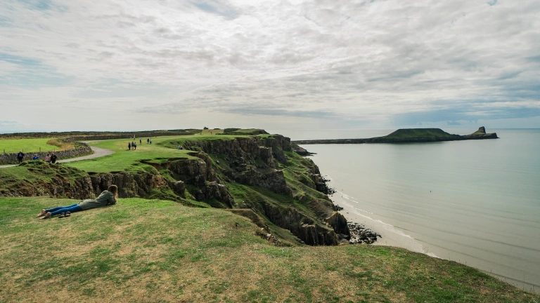
Are we allowed to say, ‘All of it’? It seems unfair to pick coastal highlights. But life’s not fair, so… Conwy for the castle, Llanddwyn Island for romance, Porthdinllaen for a pint, Portmeirion for a potter, Aberystwyth for culture, Ceinewydd (New Quay) for dolphins, Trefdraeth (Newport) for food, Sgomer for wildlife, Dinbych-y-pysgod (Tenby) for sandcastles, Three Cliffs for walks, Ynys y Barri (Barry Island) for chips … and you can pick a hundred more, for a hundred different reasons.
North Wales Pilgrim's Way
The North Wales Pilgrim's Way follows a 135 mile long distance waymarked walking route, between Basingwerk Abbey near Treffynnon (Holywell) and Ynys Enlli (Bardsey Island). This spiritually inspiring route links 6th century churches and sites of religious significance across North Wales, taking in mountain paths, beautiful waterfalls, thousand year old crosses and ancient stone circles.

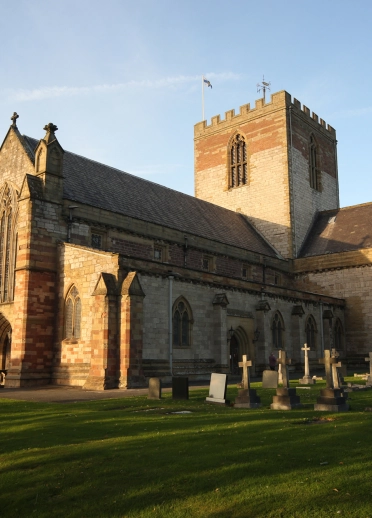
Highlights of the North Wales Pilgrim's Way
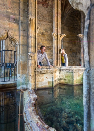
The heritage sites along the route - St Winefride's Well in Treffynnon, St Asaph Cathedral, and the Llŷn Maritime Museum in Nefyn for starters, ending up with a boat trip to the 'island of 20,000 saints' - Ynys Enlli.
The views aren't bad either.
The Taith Cambria / Cambrian Way
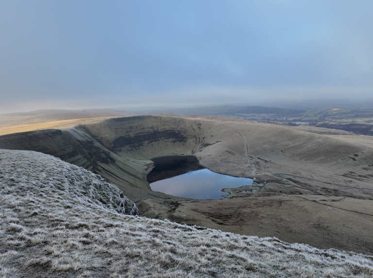
This one's a toughie. The Cambrian Way long distance trail is 481 km / 299 miles of meandering pathways between Caerdydd and Conwy. Heading firstly towards the Black Mountains, the trail then crosses westwards over the Bannau Brycheiniog (Brecon Beacons) and into the Cambrian Mountains. Then it's northwards - taking in Cader Idris, the Rhinogs, Yr Wyddfa (Snowdon) and the Carneddau mountains. Expect a lot of remote, beautifully scenic walking along the way, ascending up some of the highest peaks in Wales - there's going to be some spectacular views. While it's waymarked in lowland areas, you'll need excellent navigational skills to follow the trail up high.

Highlights of the Cambrian Way trail
Chances are you won't see many other people, especially in the more wild, remote areas. The Bannau Brycheiniog (Brecon Beacons) and Cambrian Mountains are Dark Sky sites so expect brilliant stargazing opportunities. Heritage sites along the way include iron age forts, castles, churches and ruined abbeys. You'll definitely tick off a few trig points.
Useful information
There are several apps to download, and websites with loads of useful information about the various trails. As well as the Wales Coast Path app and the Wales Coast Explorer app, check out the HistoryPoints website. Using QR codes, you can scan one of the hundreds of HiPoint locations with your smart phone and discover more about that particular place. They have many fascinating history tour itineraries along our long distance trails and in towns.
Using our main line railway network, there are several walks you can easily access and complete. The Rail to Trail website is a great resource for planning walks on our long distance paths, and for shorter walk inspiration.
- Before you head out, please read our safety advice for exploring Wales' National Parks and safety tips for staying safe on the Welsh coast.
- Adventure Smart Wales has plenty of advice on how to ‘make a good day better’, and we recommend you read it before planning your days out.
- Traveline Cymru is a useful public transport journey planner.
- There are a number of apps and online maps where you can to find the location of electric vehicle charging points across Wales. Several National Trust properties across Wales have EV charging points.
- Help Wales become the first Refill Nation by using nearby Refill Points to fill up your water bottle before you head off. Find out more, including how to download the free Refill app to find your nearest Refill Point on the Refill Return website.


