
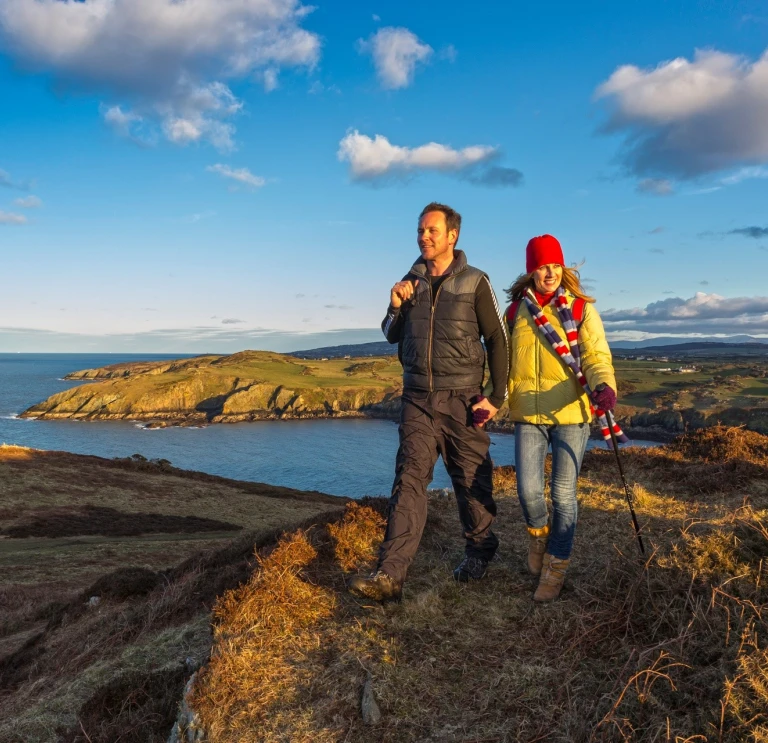
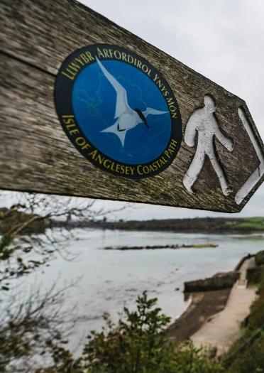
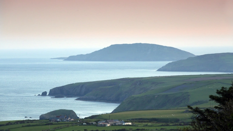
Isle of Anglesey Coast
The beautiful Ynys Môn is criss-crossed with quiet lanes and paths, making it an ideal base for walkers. Its coast path runs through spectacular scenery, with 95% of it in a National Landscape.
This is the place to come for a variety of seabirds, wildlife and a wealth of ancient history.
Read more: Bird watching on Ynys Môn with David Lindo

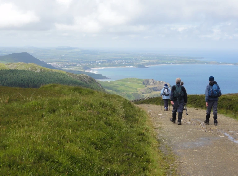
North Wales Path
The North Wales Path winds for 60 miles (96 km) along the coast from Bangor to Prestatyn, mostly along public footpaths. It takes you to traditional seaside resorts which you can reach from the path, and also gives you stunning mountain and coastal views.
Near Prestatyn, and close to the Offa's Dyke Path National Trail, the route follows the Prestatyn Dyserth Way, a 2 2/3 mile (4.3 km) former railway. Some of the most stunning views on the path are of the soaring Eryri mountains, which can be seen from Little Ormes' Head, or from Castell Conwy.
Mynydd Hiraethog Footpath
The Mynydd Hiraethog and Denbigh Moors Footpath Network includes a linear 40 mile (64km) route, together with six shorter circular routes that can each be walked individually.
The Denbigh Moors are a rare surviving part of an immense grouse moor and shooting estate. The eastern side of the moor includes the peaks of Tir Mostyn and Foel Goch, the Clocaenog Forest and the two major valleys of the moorland, the Alwen and Brenig.
The 'Edge of Wales' walk
The Edge of Wales, a relatively new coastal path, along the top of the Pen Llŷn (Llŷn Peninsula), following pilgrim's routes to Ynys Enlli (Bardsey Island). The walk is 'the only long distance walk in Britain to finish with a sea voyage to an island, and a real adventure,' according to co-ordinator Peter Hewlett.
The route takes in many of the most breathtaking views and loveliest villages in Llŷn, and is ideal for walking end to end, or in small chunks as day walks.
North Wales Pilgrim's Way
Take some time out and follow in the spiritual footsteps of our ancestors by following this recently created trail. The North Wales Pilgrim's Way follows a 135-mile long distance waymarked walking route, between Basingwerk Abbey near Treffynnon (Holywell) and Ynys Enlli. The route links 6th century churches and sites of religious significance across North Wales, taking in mountains, waterfalls, thousand-year old crosses and stone circles.

Mary Jones Walk
The Mary Jones Walk is a 28-mile walk through the Eryri National Park. It is a bracing walk to undertake in sections, but consider the 15-year-old girl the walk is named after, who walked the entire distance barefoot in 1800 to buy a bible from Y Bala (Bala).
She saved what little money she had for six years to afford her bible and walked from Llanfihangel-y-Pennant across valleys and around mountains to Llyn Tegid (Bala Lake). Her journey inspired the founding of the Bible Society.

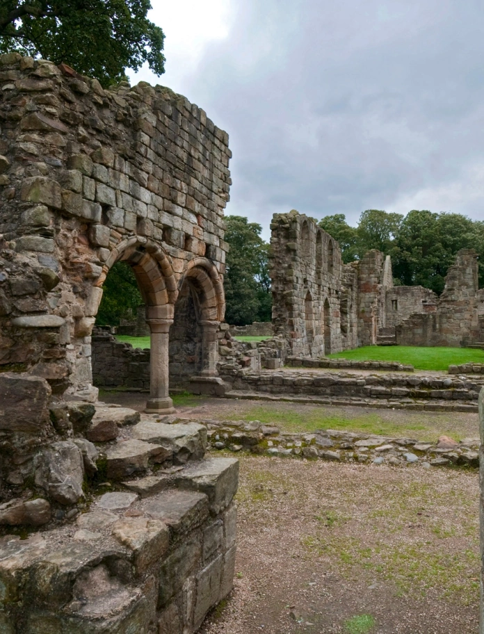
Wat's Dyke
The Wat's Dyke trail follows the route of the channel using public footpaths and quiet country lanes for a distance of 61 miles (99km) between Llanymynech, close to the Powys/Shropshire border and Basingwerk Abbey, which is within a stone’s throw of the River Dee estuary near Treffynnon in Flintshire.
Taith Ardudwy Way
Taith Ardudwy Way is a well signposted upland pathway of 24 miles (38km) from Abermawf in the south to Llandecwyn in the north.
The Way traverses Ardudwy, an ancient commote (an administrative area in the Middle Ages). It visits each of the parishes bordering Bae Ceredigion (Cardigan Bay) and crosses the geological formation of Cambrian Rocks, amongst the oldest in Wales, known as the Harlech Dome. The Way takes in some of the best coastal and mountain views in Wales, passes prehistoric sites, and provides the chance to see varied vegetation and rare birds in the area.


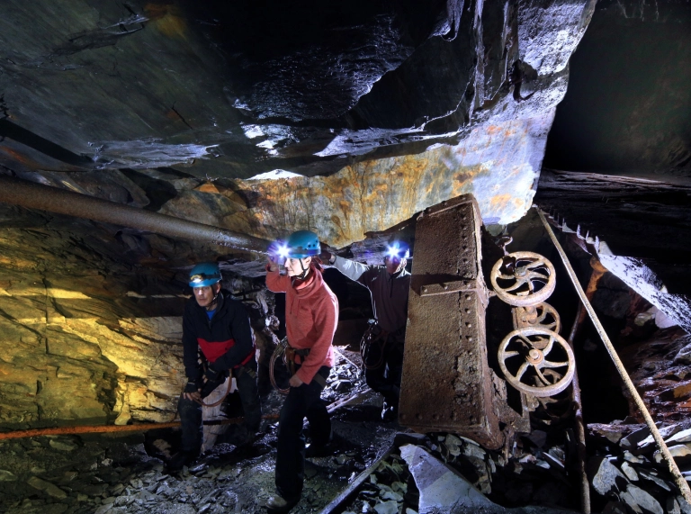
Eryri Slate Trail
Explore the industrial heritage of North Wales' slate landscape with this 83 mile circular walk, starting in Bangor and ending in Bethesda. The trail follows quieter routes through Eryri, linking Llanberis, the Nantlle Valley, Beddgelert, Llan Ffestiniog and Betws-y-Coed. The Eryri Slate Trail can be completed over seven days or section by section.

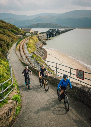
The Mawddach Trail
The Mawddach Trail is a beautiful traffic-free walking and cycling route along the Mawddach Estuary between Abermaw and Dolgellau. Following the route of a disused railway line, the 9.5 miles (15km) flat path provides gorgeous views of the mountains and estuary. Along the way, you can visit RSPB Mawddach Valley - Arthog Bog, have a bite to eat in the George III or have a picnic at one of the many stopping points along the way. You can use public transport to travel back to your starting point - TravelineCymru can help with planning.
Be safe!
Exploring the outdoors is fantastic fun, but please read up on the risks and make sure you are prepared.
- Find safety advice for exploring Wales' National Parks and safety tips for staying safe on the Welsh coast.
- Visit AdventureSmart.uk for information on how to stay safe whilst exploring Wales.
Useful information
- Download the Y Marilyns app – find a recommended starting point, a short route description and background information for Welsh hills and mountains which are 150m or more higher than the surrounding land (this is classed as a ‘Marilyn’). The app is free to download and is run by volunteers from the Relative Hills Society.
- Traveline Cymru is a useful public transport journey planner.
- There are a number of apps and online maps, where you can find the location of electric vehicle (EV) charging points across Wales. These include the Transport for Wales EV charging points in Wales page. Several National Trust properties across Wales have EV charging points.
- Help Wales become the first Refill Nation by using nearby Refill Points to fill up your water bottle before you head off. Find out more, including how to download the free Refill app to find your nearest Refill Point on the Refill Return website.


