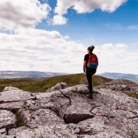
What is a UNESCO Global Geopark?
There are currently 229 UNESCO Global Geoparks in 50 countries around the world, and here in Cymru, we’re lucky to have two spectacular examples: Fforest Fawr and GeoMôn. The name of these globally recognised parks offers a clue to what makes them so special. Quite simply, they are places of exceptional geological importance. That means that the rocks under your feet when you stand on a beach or in parkland, and those above your head in the form of cliffs and peaks have an important story to tell of the history of the land, the plants and animals that have used it and how we as humans fit into the picture.
But Geoparks are about more than just rocks, they’re about stories: of history, time, people, and industry. They focus on local communities and sustainable tourism, and how we as responsible travellers are inextricably linked to the world around us. Plus, they make great places for day trips, weekend jaunts and extended holidays thanks to the huge range of activities and sights on offer.
Wales also has four impressive UNESCO World Heritage Sites, including our newest site, The Slate Landscape of Northwest Wales. And we're also proud to be home to the unique and beautiful UNESCO Dyfi Biosphere in Mid Wales.
GeoMôn Geopark
What is it?
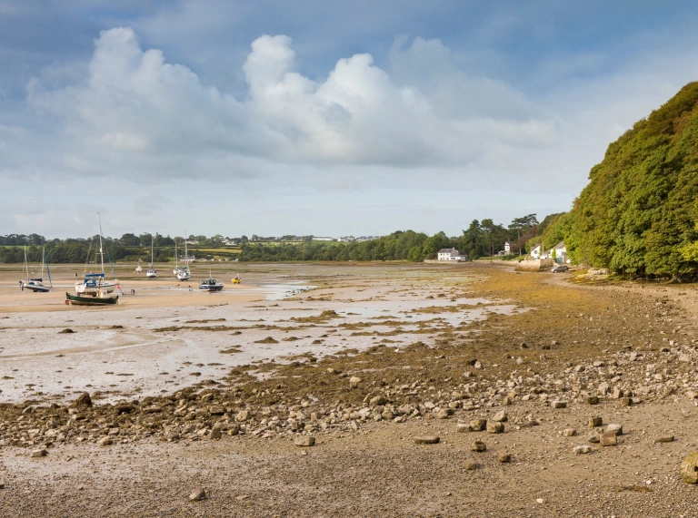
Covering the entire island of Ynys Môn (Anglesey in North Wales, GeoMôn has some of the oldest rocks in the UK, from beaches with 860-million-year-old fossils to curious pillow lavas (volcanic rocks in the shape of the pillows on your bed). As geoscientist and chair of the GeoMôn trustees, Professor Colin Jago puts it, ‘The rocks here are a history lesson in how the earth works. They tell us about major events in the past from up to 500 to 600 million years ago or more. If you wander around and look at the rocks in GeoMôn, you can see evidence of when Ynys Môn was a desert with no rain, or when the island was an idyllic tropical region with coral reefs, or a time when it was covered by kilometre-thick ice sheets.’
What can I do there?
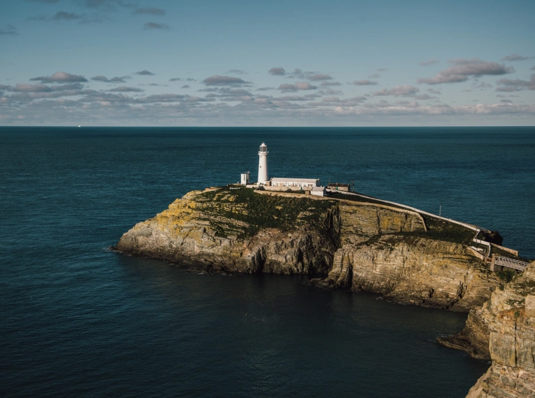
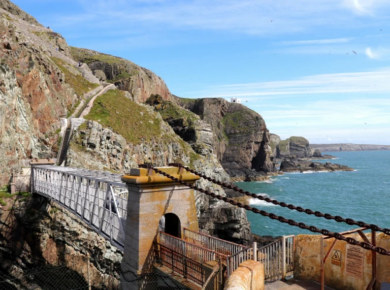
Thanks to Ynys Môn’s geology and relatively small stature, you could do the Geopark in a day, but ask any local and they’ll tell you that it’s best not to rush your rock-hunting. Start off at the famous Ynys Lawd (South Stack) Island where the brilliant-white lighthouse has been warning sailors off the historic rocks for more than 200 years. Once you make it over to the island, look back at the mainland to witness the imposing sea cliffs. ‘All of the layers you see are thickly bedded quartzites deposited 500 million years ago on the seabed of an extensive ocean when Ynys Môn was at a latitude of about 30°S – near modern day South Africa,’ says Professor Jago.
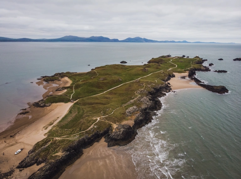
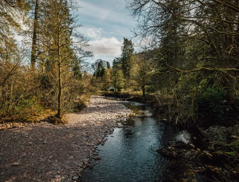
Working clockwise around Ynys Môn, families and fossil hunters should head to the beaches of Cemaes (north coast) and Traeth Coch (Red Wharf) (east coast), where as well as enjoying the sand and rock pools, you’ll easily be able to find and see all sorts of fossilised remains including corals and brachiopods. Although, one of the largest sandy beaches on Anglesey is Newborough, which is backed by one of the most extensive sand dune fields in the UK – huge areas of farmland that were covered by sand during storms in the 14th century. At the northern end of the beach, at the junction with Llanddwyn Island, you’ll find the spectacular pillow lavas created 580 million years ago when molten lava bubbled up through the seafloor.
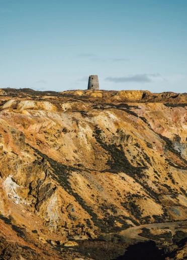
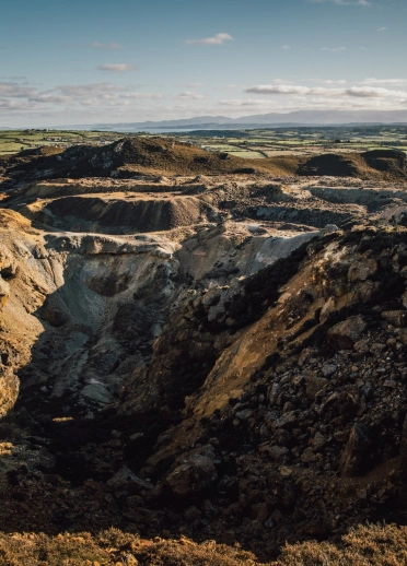
It’s not just natural landscape in GeoMôn, the copper mine at Mynydd Parys (Parys Mountain) near Amlwch was once upon a time the largest copper mine in the world. You can still see how man has carved into the rock and added another layer of history and complexity to the land around you. The unusual terrain makes this a favourite spot for hikers. While in Amlwch, head to the Geopark visitor centre where you’ll find an exhibition that takes you through 600 million years of Ynys Môn life, plotting where it was, what the temperature was, what the land looked like and how the earth’s climate has changed – and continues to do so. It’s from here that you can head out on guided tours with the volunteers who run the park, and pick up leaflets and guides to help you explore. Before you go, grab a copy of Footsteps Through Time - there are 14 fully illustrated geotrails to follow on the island and explains the geology you’ll witness.
What other attractions are nearby?
As the Geopark covers the whole island, you can split your time between fascinating geological and cultural sites. Take in the impressive engineering and architecture of the Menai Suspension Bridge or visit the famous station at Llanfairpwll for that perfect wide-angle selfie. Active adventurers of all ages should book onto a coastal kayak tour with B-Active Rhoscolyn where you’ll get up close and personal with the cliffs, caves and coves of the Anglesey coastline. For foodie finds, head to Porthaethwy (Menai Bridge), where Sosban & The Old Butchers Restaurant serves up Michelin-star menus, or try nearby Dylan’s for something a bit more casual – think fresh local seafood and pizzas. Don’t leave without stocking up on homemade chutneys, sauces and preserves.
Search for more Ynys Môn attractions and activities.
Professor Colin Jago, GeoMôn trusteeThe rocks here are a history lesson in how the earth works. They tell us about major events in the past from up to 500 to 600 million years ago or more."
How do I get there?
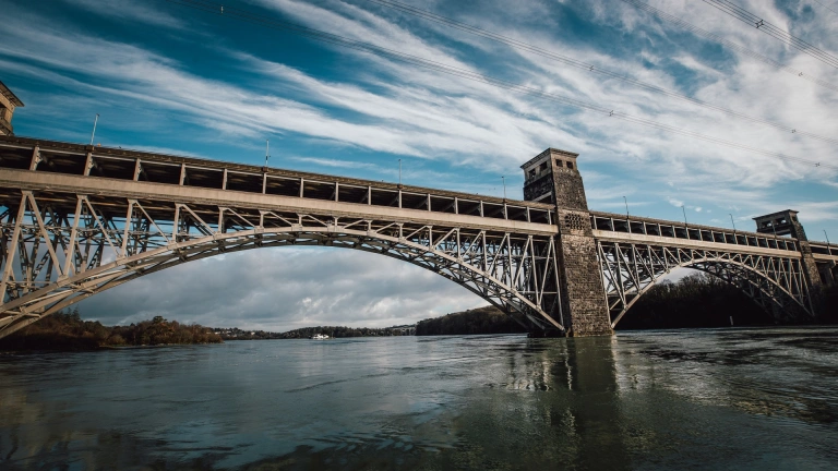
As the Geopark encompasses the whole island, accessibility is pretty straightforward. Major roads (the A5 and A55), will lead you to Porthaethwy where you can cross over onto the island. The North Wales Coast Railway trains cross the Britannia Bridge – constructed from Carboniferous limestone quarried at Penmon – with stops including Llanfair PG, Bodorgan, Ty Croes, Rhosneigr and Valley. Traveline Cymru is a useful public transport journey planner.
Search for Ynys Môn accommodation.
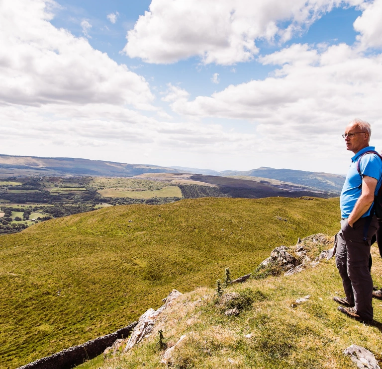
Fforest Fawr Geopark
What is it?
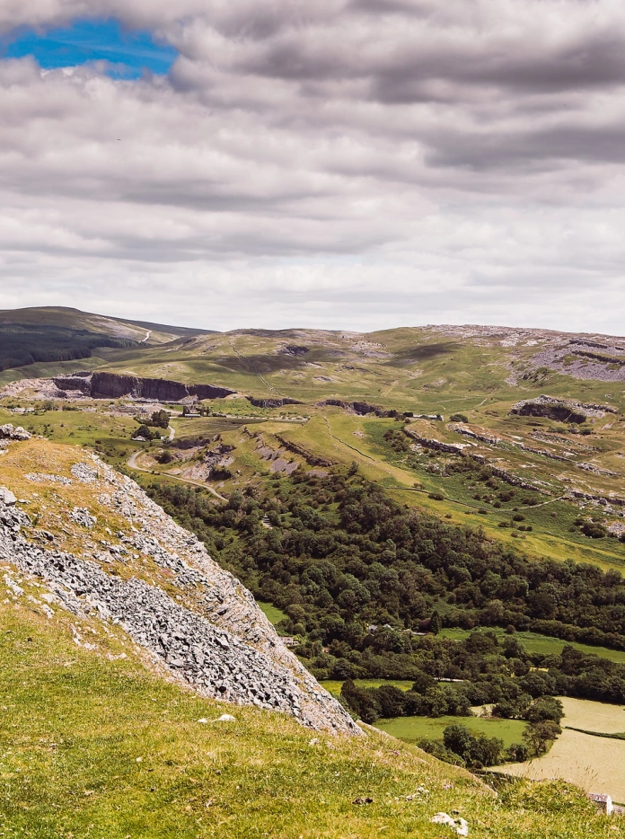
Stretching over 300 square miles (777 square kilometres) from the Usk valley in the east to the Towy in the west, the Fforest Fawr Geopark covers half of the Bannau Brycheiniog (Brecon Beacons) National Park. The 470-million-year-old landscape is incredibly diverse. As Geopark development officer Alan Bowring says, ‘We've got the Bannau Brycheiniog and the Black Mountain – the legacy of the glaciers and what the Ice Age left us. You’ll see lots of wildlife, such as red kites. But on the southern fringe, you've got the legacy of South Wales as one of the birthplaces of the Industrial Revolution. What that means is that many of the old tram roads are now walking and cycling routes. And nature's taking back the industrial landscape, with birds nesting on the quarry faces that 150 years ago were supplying raw materials to the world’.
What can I do there?
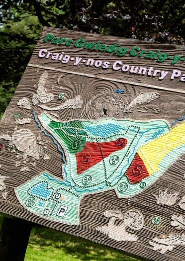
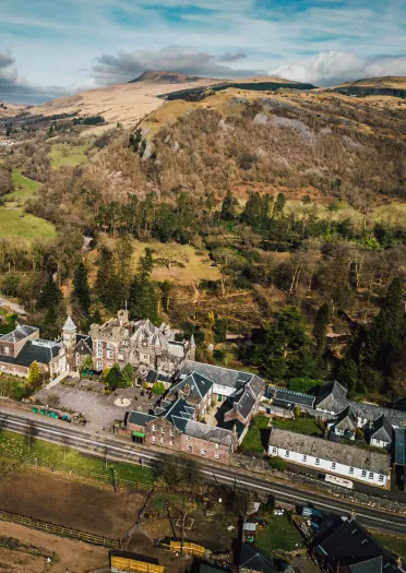
Craig-y-nos Country Park is the gateway to the Geopark from the southwest. The 40-acre country estate is part of the grounds of the historic Craig Y Nos Castle (former residence of opera superstar Adelina Patti) and home to walks and nature trails as well as a tearoom. It also houses the Geopark Discovery Point – a stellar starting location for venturing further into the park with information and guides. The walking and rambling routes from here are particularly good for families with older children. Try the circular walk along the Cribarth Ridge to Cribarth Hill. You’ll see how both the glaciers and man have carved the limestone and sandstone. This part of the park is also known for its great stargazing opportunities – just remember to wrap up warm.
Geoparks are as much about culture as the land, and perhaps one of the best examples of the two going hand in hand is Y Garn Goch near the town of Bethlehem. Here, you’ll experience one of Europe’s largest iron age hill forts. Think of it as ancient tower where throngs of people would have lived and traded. You’ll be able to walk around the remains of the enormous stone defensive walls and see for miles across the countryside – photographers take note.
Many of the Fforest Fawr’s most famous spots have become very popular in recent years, and the Geopark is encouraging visitors to act responsibly if and when they visit. The majestic Pen y Fan mountain and ethereal Waterfall Country are both areas that need protecting. If you do want to visit, then consider going out of season or visiting alternative – but no less magnificent – spots to help the Geopark protect and persevere these incredible natural environments for generations to come – as well as the plants and wildlife that live there.
What other attractions are nearby?
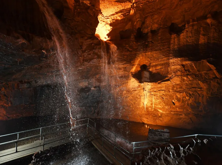
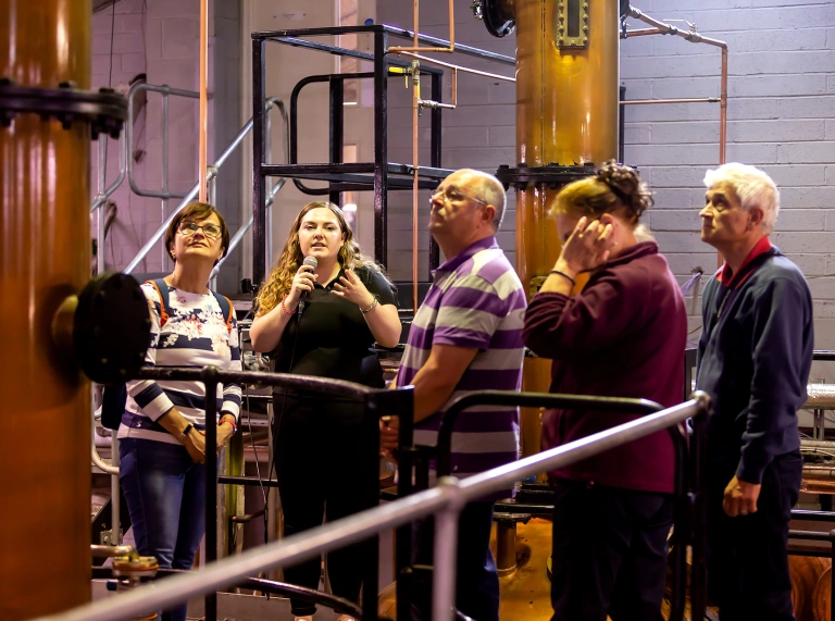
If you’re looking for to get more up-close and personal with the rocks (and some prehistoric monsters) then head for the National Showcaves Centre for Wales. You’ll journey back in time as you’re guided through the 10-mile (17-kilometre) long cave system. For something with less exertion, jump aboard the steam trains of the Brecon Mountain Railway. It’ll carry you in style the full length of the Taf Fechan Reservoir before climbing to Torpantau, the summit of the original line. If you are bracing the Geopark when the weather gets a bit chilly or damp, why not warm up with a visit to the famous Penderyn Distillery, and sample their award-winning Welsh malt whisky (plus other enticing spirits)?
Search for more attractions and activities in the Bannau Brycheiniog (Brecon Beacons).
How do I get there?
Covering such a large area, there are many ways to enter the Geopark, but the Heart of Wales Line runs along the Towy Valley with stations at Llandovery, Llangadog, Llandeilo and Rhydaman (Ammanford). Mainline trains also serve Merthyr Tudful, Y Fenni (Abergavenny) and Aberhonddu (Brecon). The park is easily accessible by car, as the A40 runs along the northern edge of the Geopark from Y Fenni to Aberhonddu, the A465 'Heads of the Valleys Road' hugs the southern border of from Merthyr Tudful to the Vale of Neath, where it joins the M4. You can use Traveline Cymru to search for public transport options.
Search for places to stay in the Bannau Brycheiniog.