The A5 gateway to North Wales and Anglesey
Castles, coastlines, and the beauty of island life
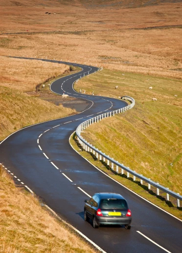
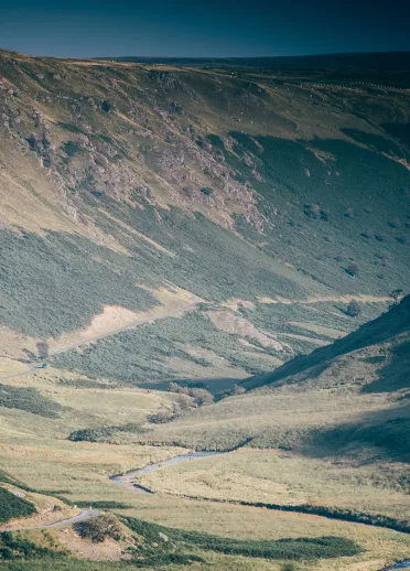
The A5 is a leisurely alternative drive into North Wales, tracing the historic route to Holyhead. It crosses the border near Chirk Castle, passes through Llangollen - where the scenic Horseshoe Pass is well worth a dramatic detour - and heads into Eryri (Snowdonia). The stretch beyond Capel Curig through the Ogwen Valley is especially spectacular, cutting between the Carneddau and Glyderau mountain ranges, with the jagged spine of Tryfan standing proud.
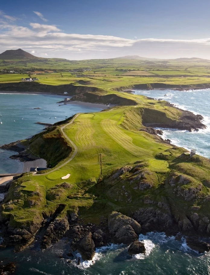
To reach Anglesey, you can cross either Thomas Telford’s 19th century Menai Suspension Bridge or the faster Britannia Bridge, which offers sweeping views of the Menai Strait. Once on the island, a 75 mile circular drive offers a memorable road trip. Don't miss the village with the longest name in Europe, Llanfairpwllgwyngyllgogerychwyrndrobwllllantysiliogogogoch or Anglesey's 125 miles of coastline with highlights like Rhoscolyn’s sea arches, Aberffraw’s dunes, and the ever-popular Benllech Beach.
Distance: Approx. 130 miles (210 km) from Chirk (near the England-Wales border) to Holyhead on Anglesey.
Estimated Driving Time: Around 3.5 to 4 hours, depending on stops and detours. A tour of the entire island of Anglesey will take approximately 4 hours.
Highlights along the way:
- Llanddwyn Island - This narrow finger of land is an ideal picnic site. It’s home to the ruins of a chapel dedicated to St Dwynwen, the Welsh patron saint of lovers, giving the island its nickname, the Island of Love
- Beaumaris Castle - A UNESCO World Heritage Site and one of Edward I’s finest 'Iron Ring' castles.
- Ynys Lawd (South Stack Lighthouse) - A dramatic coastal spot near Holyhead, famous for its lighthouse, also great for bird watching opportunities.


Scenic drives in Eryri (Snowdonia)
The A5 from Llangollen to Eryri (Snowdonia)
Heading into North Wales from the Midlands, the A5 is a popular holiday route into Eryri (Snowdonia). But for those willing to take a 20-mile detour, the EVO Triangle, formed by the B4501, A543, and A5, is a pristine loop of tarmac made famous by EVO magazine as a supercar testing route. It's a favourite among car enthusiasts and motorcyclists alike.
Distance : 20 miles
Estimated driving time: 30-45 minutes (without stops)
Highlights along the way:
- Llyn Brenig - offers stunning lakeside views and a peaceful setting for walking, cycling, and water-based activities.
- Clocaenog Forest - a haven for wildlife and nature lovers, with scenic trails through ancient woodland.
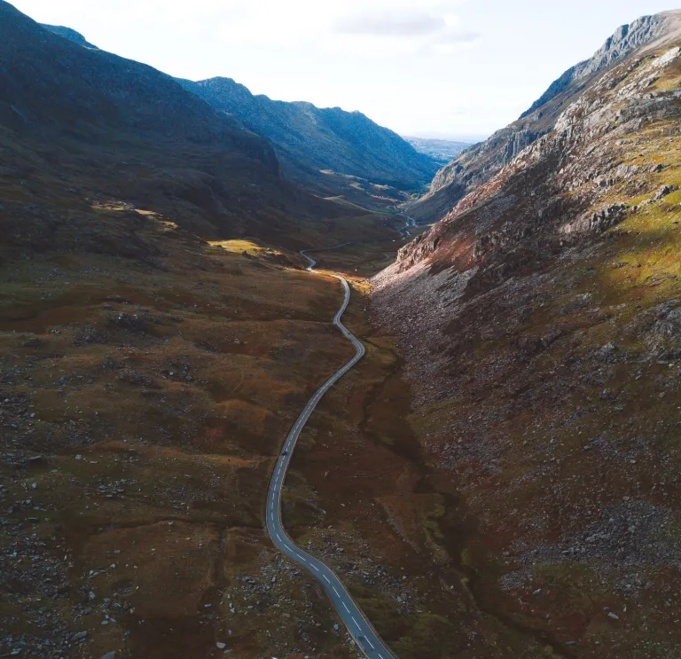
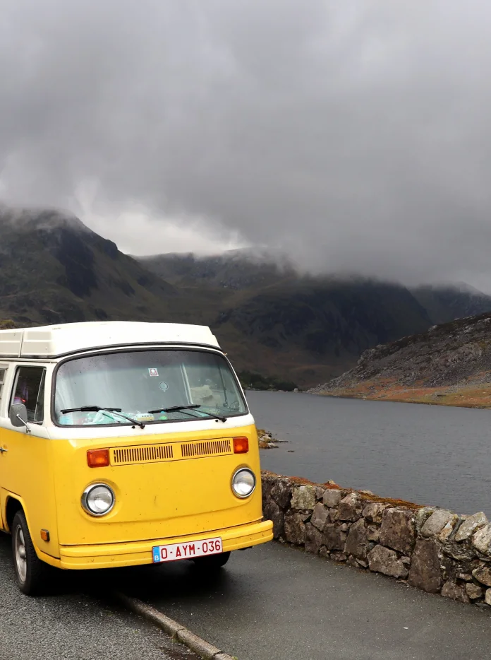
Another unmissable stretch is the A5 past Llyn Ogwen into the mountains, flanked by the dramatic peaks of Tryfan and the Glyderau on one side, and the Carneddau on the other. Keep an eye out for low-flying military jets weaving through the mountain passes - you'll hear them coming!
Distance from EVO Triangle to Llyn Ogwen: 30 miles
Time to drive: 45-60 minutes
Highlights along the way:
- Llangollen – Wales’ white-water capital.
- Pontcysyllte Aqueduct – A UNESCO World Heritage Site.
- Betws-y-Coed – The country’s most 'outdoorsy' town.
- Tryfan – A thrilling introduction to mountaineering and one of the most recognisable peaks in Britain.
- Zip World Velocity (Bethesda) – The longest zip line in the northern hemisphere, and the fastest in the world.
A lap of Yr Wyddfa (Snowdon)
For a full circuit around Eryri’s central massif, take the anti-clockwise route for the best views of Yr Wyddfa (Snowdon). Start in Caernarfon and follow the A4085 through Rhyd-Ddu, where you’ll glimpse the summit café on the mountain’s gentler western slopes. Turn left at Beddgelert onto the A498 for more dramatic views of the jagged and triangular summit. Continue to Pen y Gwryd, then ascend through the iconic Llanberis Pass to Pen-y-Pass, the starting point for the most popular walking routes. From there, it’s downhill to Llanberis and back to Caernarfon. This iconic route combines mountain roads, historic villages and some of the best views in Wales.
Distance - 35 miles
Time to drive- 1.5 to 2 hours (without stops)
Highlights along the way :
- Beddgelert - which takes its name from a heart-wrenching Welsh legend, where the loyal hound Gelert was slain by his master Prince Llywelyn, after protecting his son from a wolf and now lies buried in the village.
- Welsh Highland Railway – a breathtaking journey from Porthmadog through the Aberglaslyn Pass and Beddgelert.
- Yr Wyddfa (Snowdon) – Hike from Pen-y-Pass to the summit of Wales' highest mountain or take the train from Llanberis.
- National Slate Museum (Llanberis) – a fascinating insight into Wales’ industrial heritage.
- Caernarfon Castle – A mighty fortress steeped in history.

The Cambrian Mountains – across the wild spine of Wales
High roads and hidden Valleys
The Cambrian Mountains form the untamed backbone of Wales, and one of the most scenic routes across them begins in the refined seaside town of Aberystwyth. From here, take the A4120 to Devil’s Bridge, then follow the B4574 through Cwmystwyth, as the road climbs into the highlands past the Elan Valley reservoirs. The road eventually descends into the market town of Rhayader after a journey full of sweeping views set against the dramatic upland scenery.
Highlights along the way:
- Devil’s Bridge – a trio of stacked bridges and plunging waterfalls in a deep wooded gorge.
- Cwmystwyth – a remote village surrounded by wild hills and the remnants of old lead mines.
- Elan Valley – a string of reservoirs and dams set in a dramatic upland landscape.
Distance: 35 miles (56km)
Driving time: Around 1hr 15 minutes


Ystwyth Valley and Nant-y-moch - a scenic loop
For a quieter circular drive, head north from Aberystwyth into the Ystwyth Valley, skirting the western slopes of Pumlumon and crossing the dam at Nant-y-Moch Reservoir. This route offers a mix of forest, moorland, and mountain views, with a perfect pit-stop at Bwlch Nant yr Arian Visitor Centre to watch the red kites feeding frenzy.
Distance: approx 40 miles
Driving time: Around 1.5 hours (with time to stop and explore)


Highlights along the way:
- Teifi Pools - Llyn Egnant, Llyn Hir, and Llyn Teifi are upland lakes located close together at the end of a remote mountain road, about five miles from Ffair Rhos, near the Pontrhydygroes–Pontrhydfendigaid road
- Llyn Clywedog -Locals often skip the main road between Machynlleth and Llanidloes by taking the narrow mountain road past Llyn Clywedog. It’s a twisty but manageable route with stunning views—especially heading north.
- Optional detour - consider taking a pit stop to explore Llanidloes, Hafren Forest and all around the vast and beautiful Llyn Clywedog.
- Cardigan Bay vistas – as you descend back toward Aberystwyth, the sea opens up in the distance, framed by the Cambrian peaks.
A spectacular route - watch the video below to experience the journey!
Llŷn Peninsula coastal drive: Top stops and views
Starting from Abersoch, you can easily spend a few hours, or even days, driving around the tip of Llŷn to discover the peninsula’s wilder north coast. Head past Porth Neigwl's (Hell’s Mouth) four-mile (7km) beach to Aberdaron, before continuing up the coast. You’ll pass the ‘whistling sands’ of Porthor (they squeak when you walk on them), Nefyn Golf Club (a spectacular links golf course which feels as if you are playing off the deck of an aircraft carrier!)
Distance - 14 miles (22.5km)
Driving time -around 1 hour 45 (without stops)
Highlights along the way:
- Aberdaron - A charming fishing village on the western tip of the peninsula.
- Ty Coch Inn, Porthdinllaen - a hidden beach hamlet known in Welsh as Morfa Nefyn which is only only accessible on foot and home to the Ty Coch Inn, often ranked among the best beach pubs in the world.
- Nant Gwrtheyrn - A former quarrying village now a major Welsh language and heritage centre.
Iconic Welsh mountain passes
Tal-y-llyn Pass
From Dolgellau, take the A470 southbound, then pick up the A487 to Minffordd. This leads you through one of the most spectacular mountain passes in Wales - the Tal-y-llyn Pass - with Cader Idris high above you to the right. The hills are often lined with aircraft spotters as this is the Mach Loop, where dare devil jet pilots from the RAF (and several other air forces) test their low-flying skills, often descending to 250 feet (75m).
Distance : 25 miles (40km) from Aberystwyth
Driving time : 1 hour (via A487)
Highlights along the way:
- Talyllyn Railway - the signs to Tywyn take you back to the coast through beautiful countryside, passing the Tal-y-llyn Railway along the way.
- Castell y Bere (Cadw) - head deeper into the Dysynni Valley and explore the remote ruins of Castell y Bere and the nearby home of national icon Mary Jones who walked 26 miles barefoot to buy a copy of the Welsh Bible.
Abergwesyn Pass
This lonely stretch of rough single track runs from Llanwrtyd Wells to Tregaron cutting through a wild landscape of moorland, pine forest, and tumbling streams. The infamous Devil’s Staircase - a steep series of hairpins - adds to the thrill of the journey. It’s not a fast drive, but that’s the point. This is solitude on four wheels.
Highlights along the way:
- Soar y Mynydd - the most remote chapel in Wales, well worth a short diversion.
- Llyn Brianne Reservoir - a peaceful spot for a picnic or photo stop.
- RSPB Gwenffrwd-Dinas reserve - lush riverside nature reserve.
Distance: Approx. 20 miles (32 km)
Driving time: Around 1 hour (allow more for stops)
Bwlch y Groes
Also known as the A4069, this winding mountain road through Bannau Brycheiniog (Brecon Beacons) is a favourite with drivers, bikers, and film crews alike. Best tackled north to south for the full driving experience - especially the hairpin known as Tro Gwcw (‘cuckoo turn’). Whichever way you go, the views of the Tywi Valley are unforgettable.
Highlights along the way:
- Llyn y Fan Fach - a legendary lake nestled beneath the Carmarthen Fans.
- Castell Carreg Cennen - A dramatic hilltop ruin just to the west of the route.
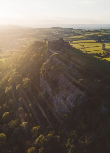
- Castell Dinefwr - A dramatic ruin perched high above the Tywi Valley, surrounded by ancient parkland.
Distance: Approx 20 miles (32km)
Driving time: Around 1 hour ( allow more for stops)
Ready to hit the road?