
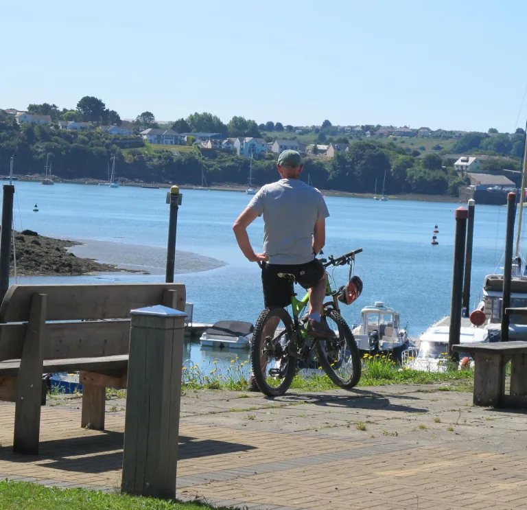
The Brunel Trail – Cruise through a nature reserve to historic Neyland Marina
Trail info: Family-friendly - 8 miles round trip - mostly flat
Kicking off close to the county town of Haverfordwest, the Brunel Trail trail follows the former Great Western Railway link route to Neyland. It’s mainly flat, on traffic-free tarmacked trails with just a couple of quiet road crossings.

Start: The free Greenhall Park car park in Johnston (from Haverfordwest, turn left off the main road following signs to Rosemarket, right after the bridge, then right again).
Set off along the trail at the far end of the car park and freewheel down a gentle incline. You’ll soon leave the village behind, and fields will spread out on either side of the tree-lined trail. Look out for three quiet road crossings at stepped gates.
Towards the end of the ride, you’ll be cruising through the tidal pools of Westfield Pill Nature Reserve, where you can stop for a picnic or continue to the marina for ice cream and coffee. After a tour of the historic marina, head back along the same path.
Extend the trail: Start at Haverfordwest County Hall (free parking for trail users on the weekends) or the nearby pay and display car parks. From there, follow the cycle path alongside the busy Freemens Way towards Merlin’s Bridge. Cross straight over the roundabout following signs for the Route 4 cycle path to Neyland. You’ll then join a bridleway and make your way to Johnston, adding around 10 miles to the route and some sweeping countryside views after a steady climb.


The Gwaun Valley Trail – Quiet country roads with a microbrewery pitstop
Trail info: Suitable for older children - 11 miles round trip - mostly flat, but with a few hills
Tucked away in the north of the county, the Gwaun Valley is one of Pembrokeshire’s more hidden corners. In summer, the hedgerows grow tall with fox gloves and honeysuckle and the densest ‘traffic’ you’re likely to meet will be a herd of cows sauntering by.


Start: The free Allt Clun car park and picnic site, at the western end of the valley.
Turn right out of the car park, cross the small bridge and follow the road along the valley floor. The Gwaun Valley Trail route gently undulates through woods and fields, with the gentle gurgle of the river meandering alongside.
Towards the end of the valley, the route starts to climb, and then a road forks off to the left, signposted to the Bluestone Brewery. Here you can mark your halfway point with a pint.
Afterwards, either return the way you came or take the high road back across the top of the valley for views of lonely standing stones, the Preseli Hills and the wooded valley below.
Extend the trail: Alternatively, take a 6-mile (round trip) detour to Pentre Ifan Burial Chamber before returning along either route to the valley car park.


The Dramway Trail – A relaxing route through a wooded valley to the sea
Trail info: Family-friendly - 4 miles - all flat and mostly off-road
Start: The free Ironworks car park, Stepaside.
Before heading along the Dramway Trail take a look around the old iron works buildings. On leaving the car park, turn right along a gravelled cycle path. You’ll be sharing a tree-lined path through Pleasant Valley with other bikers, joggers and dog walkers.


After a mile or so, emerge at the coast in Wiseman’s Bridge, cross the beach road and continue right along the shared path with views across the bay towards Tenby, and over to the Gower on a clear day. Follow the trail through three short tunnels (dismounting to traverse the tunnels) to Saundersfoot Harbour. Return along the same route.
This part of the coast is dotted with family-friendly sandy beaches, so pack your beach gear and make a day of it. There’s plenty of food choices on route with the beachside Wiseman’s Bridge Inn, the Kiosk Café at Coppet Hall, and plenty of fish and chips and ice cream on offer in Saundersfoot.
Extend the trail: At Wiseman’s Bridge, turn left along the seafront and take Cliff Road to the right just beyond the pub. At the top, there’s a tarmacked trail taking you along the clifftop and joining the road at the next beach, Amroth. From there, you could turn left at the Amroth Arms and take the off-road trail to the National Trust Colby Woodland Garden. Either return the same way or follow quiet country roads back to Stepaside (with some hills).


The Canaston Woods Trail – Woodland trails to the boutique town of Narberth
Trail info: 6 miles - tarmacked trails and road cycling - some hills
Start: The free Canaston Woods car park.
To follow the Canaston Woods Trail, from the car park, turn left along a wide pathway through the woods. Keep following the trail, emerging on the other side of the woods next to a farm and a small stream that flows across the path.
From there, you’ll cycle gradually uphill on a quiet country lane, turning left at the top. Ride along the pretty Valley Road to Narberth Hill, cross the busy road and take a pathway over a stream to your left. You’ll enter a quiet cul-de-sac leading to a pavement alongside the main road where you can safely push your bike uphill, past the castle and into town.
Take some time to explore the shops and cafes of Narberth (bring panniers in case of impromptu purchases). Stopio Bike Stop Café & Bar is an ideal place to pull in for a drink or bite to eat. When you’re finished, return the way you came, or take a slightly extended route back.


Extend the trail: An alternative route back heads out of town along Cox Hill. You’ll cross a roundabout and head uphill in and through the hamlet of Robeston Wathen. Just before reaching the next roundabout, take a right and then a left into a car park adjacent to the main road.
From here, join an off-road route through an underpass and keep left to Black Pool Mill. Cross the river here, turn left onto the quiet road and almost immediately veer right along an off-road trail through the woodland and back to the Canaston Wood car park. This latter section is well suited to young children and could be cycled instead of the full route.