The charity Ramblers Cymru strives to promote walking and develop path networks in Wales. There are very few routes they haven't walked in this country. Here's a selection of a few favourite autumn walks chosen by their staff.
Brechfa Forest, Abergorlech, Carmarthenshire
1-5 miles – Chosen by James Williams of Lampeter Ramblers
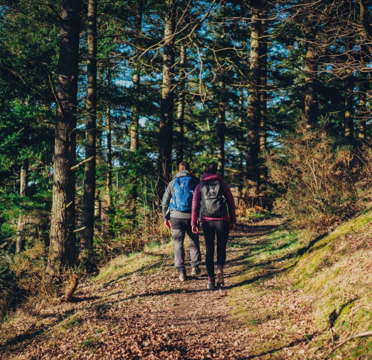
The Abergorlech walks in Brechfa Forest are run by Natural Resources Wales. In autumn, walkers can immerse themselves in a woodland that showcases trees from all over the world. The forest offers a series of walks for all abilities as well as mountain bike routes. The beautiful rivers Gorlech and Cothi run nearby.
Devil's Bridge to Cwm Rheidol, Ceredigion
7 miles – Chosen by Olie Wicks, Paths to Wellbeing Team Leader for Ramblers Cymru
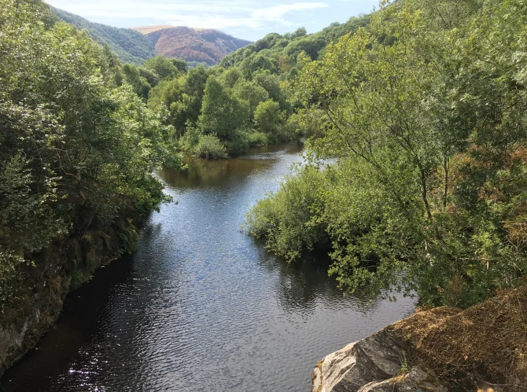
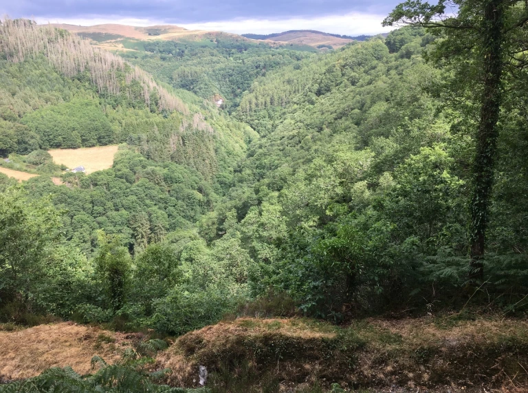
This circular walk in Mid Wales explores the spectacular Rheidol Valley. It starts in the village of Devil's Bridge, best known for its stack of three bridges over the Afon Mynach. Then, it descends into Cwm Rheidol, a steeply-sloping valley with ancient woodland and fairytale-like vistas of mossy paths, damp river banks and aged ruins before coming back up.
To extend the walk once you return to the car park, you could look to join up with part of the Cambrian Way. The 298-mile long hiking trail connects Cardiff to Conwy, but can be enjoyed in small sections. Parts of it are challenging, so always plot a realistic route before heading out. You'll find this region between stages 11 and 12 on the online Ordnance Survey Cambrian Way map.
Woodlands, Park & Coast, Barry, Vale of Glamorgan
3.5-5.5 miles – Chosen by Rebecca Brough, Policy & Advocacy Manager for Ramblers Cymru
This Valeways Millennium Heritage Trail walk is full of variety. It has a great mix of coastal views, shaded woodland, formal parks and a bit of local history thrown in. Canine pals will be glad to hear that it makes a decent dog walk too; there is plenty to keep snuffling noses interested and the woodland streams and beach offer a watery option for hounds who like a dip! There are also some lovely independent cafes on the route for a quick refreshment stop.
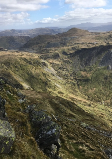
Walk up Cnicht from Croesor Circuit, Eryri (Snowdonia)
6.5 miles – Chosen by Brân Devey, Comms & Engagement Manager for Ramblers Cymru
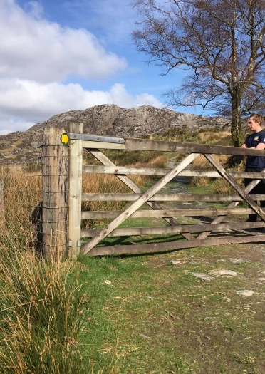
Cnicht from Croesor is commonly known as the Welsh Matterhorn. This fairly challenging route gets the blood pumping and the heart swooning for its panoramic views of the Eryri (Snowdonia) landscape. On a crisp autumn day, this route provides colourful leaves in the woodland, undulating frost-bitten hills and beautiful views of the Welsh coast.
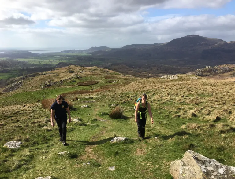
Waunfawr to Rhyd Ddu, Eryri (Snowdonia)
11 miles – Chosen by Paula Renzel
This is a particularly spectacular section of the Eryri (Snowdonia) Slate Trail, following Section 4 and Section 5. It starts with a steep ascent through the forest just outside of Waunfawr, taking you over some little-frequented moorland with stunning panoramic views of Yr Wyddfa (Snowdon), Ynys Enlli (Bardsey Island) and Anglesey, the Llŷn Peninsula, Mynydd Mawr, and the Nantlle Ridge.
After passing through Y Fron, the route takes you through the impressive remains of Dorothea Quarry, where up to 350 miners were employed at any one time between the 1820s and 1970 when it closed. From there, you drop into the Nantlle Valley and closely follow the line of the lake and river, with views on Mynydd Mawr from the other side. The last section of the route takes you up over the hill and down through a forest into Rhyd Ddu.


